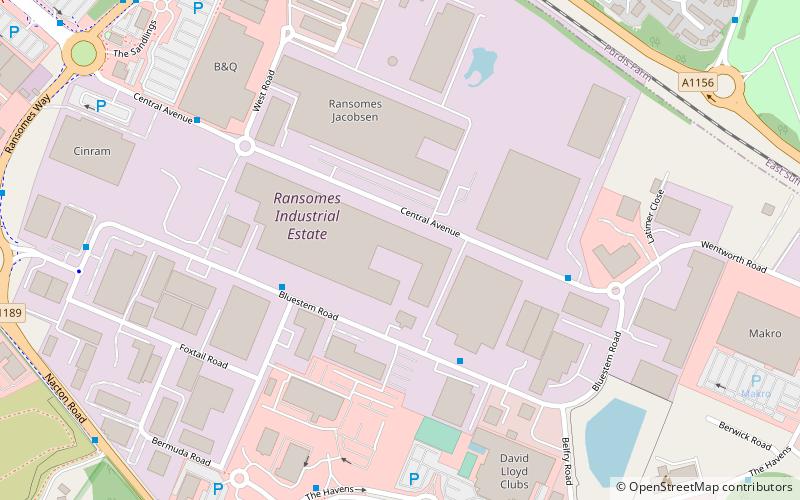
Ransomes Industrial Estate, Ipswich
Map
Facts and practical information
Elevation: 125 ft a.s.l.Coordinates: 52°1'49"N, 1°12'40"E
Address
South East Ipswich (Priory Heath)Ipswich
ContactAdd
Social media
Add
Getting there by public transportation
Public transportation stops near this location
- Bus
 Bus
Bus
- Calculate routeParcel Force 4 min walk
- Calculate routeWest Road 6 min walk
- Calculate routeCourtyard Hotel 6 min walk
- Calculate routeBelfry Road 8 min walk
Day trips


Frequently Asked Questions (FAQ)
Which popular attractions are close to Ransomes Industrial Estate?
Nearby attractions include Alnesbourne Priory, Ipswich (21 min walk), Bixley Heath, Ipswich (22 min walk).
How to get to Ransomes Industrial Estate by public transport?
The nearest stations to Ransomes Industrial Estate:
Bus
Bus
- Parcel Force • Lines: 3 (4 min walk)
- West Road • Lines: 3 (6 min walk)