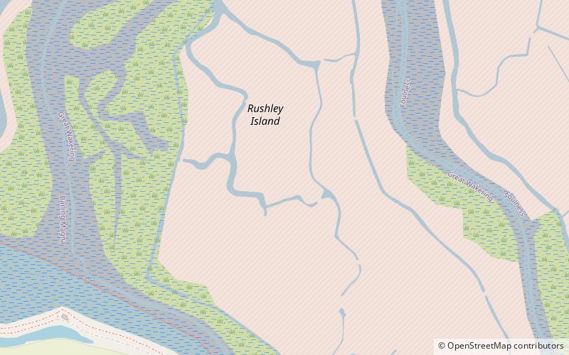
Rushley Island

Gallery (1)
Map
Map
Facts and practical information
Rushley Island is a small uninhabited island in Essex, England. It is the smallest of six islands comprising an archipelago in Essex, and is privately owned. A seawall was first constructed in the 1780s by John Harriott, and the island has been the object of farming activities since then. ()
Coordinates: 51°33'58"N, 0°49'52"E
Location
England
ContactAdd
Social media
Add
Day trips