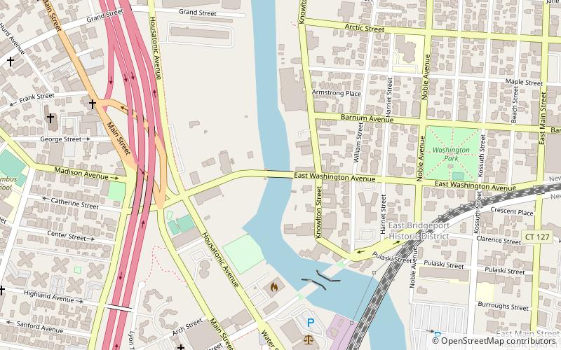
East Washington Avenue Bridge, Bridgeport
Facts and practical information
The East Washington Avenue Bridge refers to the bridges that have connected East Washington Avenue over the Pequonnock River in Bridgeport, Connecticut. Records state that a bridge was first constructed on the site in 1836, but no description of the bridge has been found. The second bridge was a truss swing design and underwent heavy repair and modernization in 1893. The third design was a movable Strauss underneath-counter weight deck-girder bascule bridge. The plans were drafted by James A. McElroy, using Joseph B. Strauss's design in 1916. However, construction was delayed for years because of a dispute with the contractor and a lack of funds. The bridge was completed by Bridgeport Dry Dock and Dredging when the State of Connecticut appropriated $350,000 to erect the bridge. Completed in 1925, the bridge underwent several modifications throughout its service life. On July 26, 1983, the bridge was closed after it was found to be in danger of collapse. It reopened after repair, but was closed in the 1990s before being replaced with a modern bascule bridge in 1998. In 2010, the report listed the deck and superstructure conditions as "Good" and the substructure condition as "Satisfactory". ()
East Bridgeport (East Side)Bridgeport
- Bus
- Train
 Bus
Bus
- Calculate routeB6 9 min walk
- Calculate routeA5 9 min walk
- Calculate routeC6 9 min walk
- Calculate routeB5 9 min walk
- Calculate routeBridgeport 15 min walk


Frequently Asked Questions (FAQ)
Which popular attractions are close to East Washington Avenue Bridge?
How to get to East Washington Avenue Bridge by public transport?
Bus
- B6 • Lines: 1 (9 min walk)
- A5 • Lines: 13 (9 min walk)
Train
- Bridgeport (15 min walk)