Peralta Park, Oakland
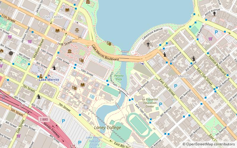
Map
Facts and practical information
The Peralta Community College District is the community college district serving northern Alameda County, California. The district operates four community colleges: Berkeley City College, Laney College and Merritt College in Oakland, and College of Alameda. From 1968 to 1988, non-contiguous Plumas County was part of the district, and Feather River College was operated by the district. Plumas County and Feather River College are now part of the Feather River Community College District. Although the district is accredited by the Accrediting Commission for Community and Junior Colleges, it was placed on probation in early 2020 for severe financial problems. ()
Elevation: 7 ft a.s.l.Coordinates: 37°47'50"N, 122°15'36"W
Address
Central Oakland (Downtown Oakland)Oakland
ContactAdd
Social media
Add
Getting there by public transportation
Public transportation stops near this location
- Metro
- Bus
- Train
- Ferry
 Metro
Metro
- Calculate routeKaiser Convention Center 2 min walk
- Calculate routeEast 10th Street & 2nd Avenue 3 min walk
- Calculate route10th Street & Fallon Street 5 min walk
- Calculate routeInternational Boulevard & 2nd Avenue 6 min walk
- Calculate routeLake Merritt 8 min walk
- Calculate routeOakland City Center - 12th Street 20 min walk
- Calculate routeOakland-Jack London Square 18 min walk
- Calculate routeOakland Jack London Square Terminal 29 min walk
Day trips


Frequently Asked Questions (FAQ)
Which popular attractions are close to Peralta Park?
Nearby attractions include Laney College, Oakland (5 min walk), Oakland Museum of California, Oakland (5 min walk), René C. Davidson Courthouse, Oakland (7 min walk), St. George Serbian Orthodox Church - Oakland, Oakland (7 min walk).
How to get to Peralta Park by public transport?
The nearest stations to Peralta Park:
Bus
Metro
Train
Ferry
Bus
- Kaiser Convention Center • Lines: 62 (2 min walk)
- East 10th Street & 2nd Avenue • Lines: 62 (3 min walk)
Metro
- Lake Merritt • Lines: Blue, Green, Orange (8 min walk)
- Oakland City Center - 12th Street • Lines: Orange, Red, Yellow (20 min walk)
Train
- Oakland-Jack London Square (18 min walk)
Ferry
- Oakland Jack London Square Terminal • Lines: San Francisco Bay Ferry (29 min walk)