Glenwood Bridge, Pittsburgh
Map

Gallery

Facts and practical information
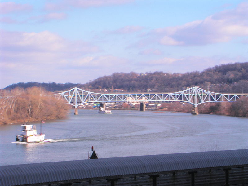
The Glenwood Bridge is a cantilever bridge in Pittsburgh, Pennsylvania, which carries Pennsylvania Route 885 over the Monongahela River. It started construction on June 3, 1958 and was completed in 1966 to replace an old decayed unsafe iron bridge built in 1894 which carried Pittsburgh Railways streetcar tracks and vehicle traffic on a wooden deck. ()
Opened: 1966 (60 years ago)Length: 2280 ftCoordinates: 40°23'46"N, 79°56'7"W
Address
Glenwood BridgeSouth Side (Hays)Pittsburgh
ContactAdd
Social media
Add
Day trips
Glenwood Bridge – popular in the area (distance from the attraction)
Nearby attractions include: Sandcastle Waterpark, St. John the Baptist Byzantine Catholic Cathedral, Homestead Grays Bridge, Pittsburgh Improv Comedy Club.
Frequently Asked Questions (FAQ)
Which popular attractions are close to Glenwood Bridge?
Nearby attractions include Glenwood B&O Railroad Bridge, Pittsburgh (7 min walk), Glen Hazel, Pittsburgh (22 min walk), New Homestead, Pittsburgh (23 min walk).
How to get to Glenwood Bridge by public transport?
The nearest stations to Glenwood Bridge:
Bus
Bus
- Waterfront Drive at Costco Driveway • Lines: 59 (25 min walk)


