Sawins pond, Boston
Map
Facts and practical information
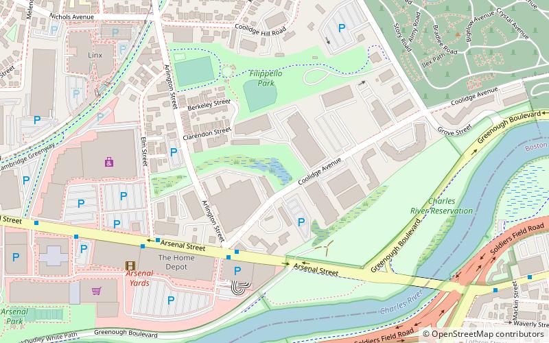
Sawins Pond is a man-made pond created in the 19th century in Watertown, Massachusetts, USA. Its banks were the site of an upscale hotel, and it was a popular fishing and swimming spot. It was then used by Hood Rubber company, and then BF Goodrich. They deposited scores of barrels onto the site, filled with rubber scraps. ()
Elevation: 16 ft a.s.l.Coordinates: 42°21'51"N, 71°9'7"W
Address
Watertown Town (East Watertown)Boston
ContactAdd
Social media
Add
Getting there by public transportation
Public transportation stops near this location
- Bus
- Light rail
 Bus
Bus
- Calculate routeCambridge St @ Dustin St 26 min walk
- Calculate routeWarren Street 32 min walk
- Calculate routeAllston Street 34 min walk
- Calculate routeGriggs Street 36 min walk
- Calculate routeHarvard Avenue 37 min walk
Maps MBTA Subway
MBTA SubwayDay trips


Frequently Asked Questions (FAQ)
Which popular attractions are close to Sawins pond?
Nearby attractions include Arsenal Street Bridge, Boston (8 min walk), St. Stephen's Armenian Apostolic Church, Boston (10 min walk), Mount Auburn Cemetery, Boston (14 min walk), Charles River Reservation Parkways, Boston (16 min walk).
How to get to Sawins pond by public transport?
The nearest stations to Sawins pond:
Bus
Light rail
Bus
- Cambridge St @ Dustin St • Lines: 57 (26 min walk)
Light rail
- Warren Street • Lines: B (32 min walk)
- Allston Street • Lines: B (34 min walk)