Bread Loaf, Green Mountain National Forest
#22 among attractions in Green Mountain National Forest
![Bread Loaf location map](https://tzmedia.b-cdn.net/media/images/static-maps/us/43_9539_-72_9932.jpg)
Facts and practical information
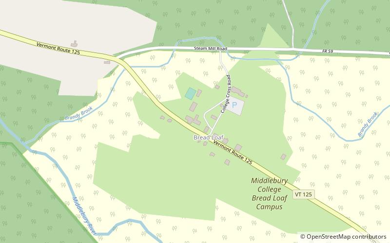
Bread Loaf is an unincorporated community within the town of Ripton in Addison County, Vermont, United States. The community is on the west flank of Bread Loaf Mountain. The community formerly had a post office, but it is now closed. ()
4265 State Route 125Green Mountain National Forest United States
Green Mountain National Forest plan & book
Unleash the traveler in you — discover the cheapest flight deals, find the perfect hotel or hostel nearby, and search for the best car rental prices. Travel at your own pace to discover new places and enjoy your journey.
Bread Loaf – popular in the area (distance from the attraction)
Nearby attractions include: Middlebury College Snow Bowl, Middlebury Gorge Concrete Arch Bridge, Branbury State Park, Lake Dunmore.
1.9 miSEWinter sport, Outdoor activities, Ski areaMiddlebury College Snow Bowl, Middlebury
49 min walk • The Middlebury College Snow Bowl is a ski area in Hancock, Vermont, 13 miles east of Middlebury in the Green Mountains. The site has been owned and operated by Middlebury College since its first trails were cut in 1934.
4.7 miWBridgeMiddlebury Gorge Concrete Arch Bridge, Middlebury
121 min walk • The Middlebury Gorge Concrete Arch Bridge is a historic concrete arch bridge, carrying Vermont Route 125 over the Middlebury River in eastern Middlebury, Vermont. The bridge was built in 1924, and is a well-preserved example of an early concrete bridge. It was listed on the National Register of Historic Places in 1991.
4.8 miSWState park, ParkBranbury State Park, Green Mountain National Forest
124 min walk • Branbury State Park is a 69-acre state park in the towns of Salisbury and Leicester, Vermont. The park is located on the eastern shore of Lake Dunmore at the base of Mt. Moosalamoo. It is divided by Vermont Route 53.
5.4 miSWNature, Natural attraction, LakeLake Dunmore, Green Mountain National Forest
138 min walk • Lake Dunmore is a freshwater lake in Addison County, Vermont. The lake spans the towns of Salisbury and Leicester and has a surface area of 985 acres. Lake Dunmore is over 3 miles long and up to 1 mile wide.
4.2 miNENature, Natural attraction, MountainBread Loaf Mountain, Green Mountain National Forest
108 min walk • Bread Loaf Mountain is a mountain located in Addison County, Vermont, in the Breadloaf Wilderness in the Green Mountain National Forest. The mountain is part of the central Green Mountains. Bread Loaf Mountain is flanked to the northeast by Mount Wilson, part of Vermont's Presidential Range.
4.9 miNENature, Natural attraction, MountainMount Wilson, Green Mountain National Forest
124 min walk • Mount Wilson is a mountain in the Green Mountains in the U.S. state of Vermont. Located in the Breadloaf Wilderness of the Green Mountain National Forest, its summit is in the town of Ripton in Addison County.
5.8 miWInteresting neighbourhoodFenn Farm, Middlebury
148 min walk • Fenn Farm is a historic property on Case Street in Middlebury, Vermont. Developed c. 1828 as a sheep farm but now diversified, it now includes a well-preserved collection of mid-19th century farm buildings.
2.6 miNWGreek Revival architecture, ChurchRipton Community House, Green Mountain National Forest
67 min walk • The Ripton Community House, formerly the Ripton Congregational Church, is a historic former church and present community hall on Vermont Route 125 in the village of Ripton, Vermont.
2.7 miSWProtected areaMoosalamoo National Recreation Area, Green Mountain National Forest
70 min walk • Moosalamoo National Recreation Area is one of two national recreation areas in the Green Mountain National Forest in the U.S. state of Vermont.
2.6 miSEMountain pass, NatureMiddlebury Gap, Green Mountain National Forest
66 min walk • Middlebury Gap, is a mountain pass in the Green Mountains of Vermont. The height of land of the pass is located in Addison County.
6.4 miSWTownSatans Kingdom, Green Mountain National Forest
164 min walk • Satans Kingdom is an unincorporated community in the town of Leicester in Addison County, Vermont, United States. It is located along Vermont Route 53 near the southern shore of Lake Dunmore and just north of Fern Lake.