John Harris Bridge, Harrisburg
Map
Facts and practical information
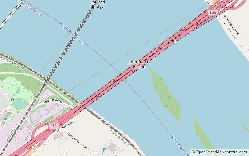
The John Harris Bridge, also known locally as the South Bridge, carries Interstate 83 and the Capital Beltway across the Susquehanna River connecting downtown Harrisburg, Pennsylvania and its western suburbs in Cumberland County, Pennsylvania. The bridge officially opened on January 22, 1960 and was later widened to six lanes. It was named in honor of John Harris, the founder of the city of Harrisburg. Since 1997, the bridge was designated to carry the Capital Beltway which loops the Harrisburg metropolitan area. ()
Coordinates: 40°14'50"N, 76°52'46"W
Address
LemoyneHarrisburg
ContactAdd
Social media
Add
Getting there by public transportation
Public transportation stops near this location
- Bus
- Train
 Bus
Bus
- Calculate routeMarket Street Transfer Station 23 min walk
- Calculate routeFlixBus Harrisburg 25 min walk
- Calculate routeHarrisburg 27 min walk
- Calculate routeHarrisburg 27 min walk
Day trips


Frequently Asked Questions (FAQ)
Which popular attractions are close to John Harris Bridge?
Nearby attractions include Dock Street Dam, Harrisburg (3 min walk), Philadelphia & Reading Railroad Bridge, Harrisburg (6 min walk), Cumberland Valley Railroad Bridge, Harrisburg (12 min walk), Shipoke, Harrisburg (14 min walk).
How to get to John Harris Bridge by public transport?
The nearest stations to John Harris Bridge:
Bus
Train
Bus
- Market Street Transfer Station (23 min walk)
- FlixBus Harrisburg • Lines: 2680 (25 min walk)
Train
- Harrisburg (27 min walk)