Blue Lake, Ansel Adams Wilderness
#7 among attractions in Ansel Adams Wilderness
Facts and practical information
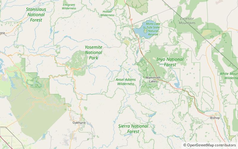
Blue Lake is a lake in Madera County, California, in the United States. ()
Ansel Adams Wilderness United States
Blue Lake – popular in the area (distance from the attraction)
Nearby attractions include: Thousand Island Lake, Banner Peak, Mount Lyell, Simmons Peak.
 Nature, Natural attraction, Lake
Thousand Island Lake, Ansel Adams Wilderness
156 min walk • Thousand Island Lake is a large alpine lake in the Sierra Nevada, within the Ansel Adams Wilderness in eastern Madera County, California. The lake is named for the many small rocky islands that dot its surface. Theodore Solomons probably established the 'Thousand Island' name, as this appears on his 1896 map.
 Nature, Natural attraction, Mountain
Banner Peak, Ansel Adams Wilderness
125 min walk • Banner Peak is the second tallest peak in the Ritter Range of California's Sierra Nevada. The mountain is 12,942 feet tall, and there are several glaciers on its slopes.
 Natural attraction, Nature, Mountain
Mount Lyell, Yosemite National Park
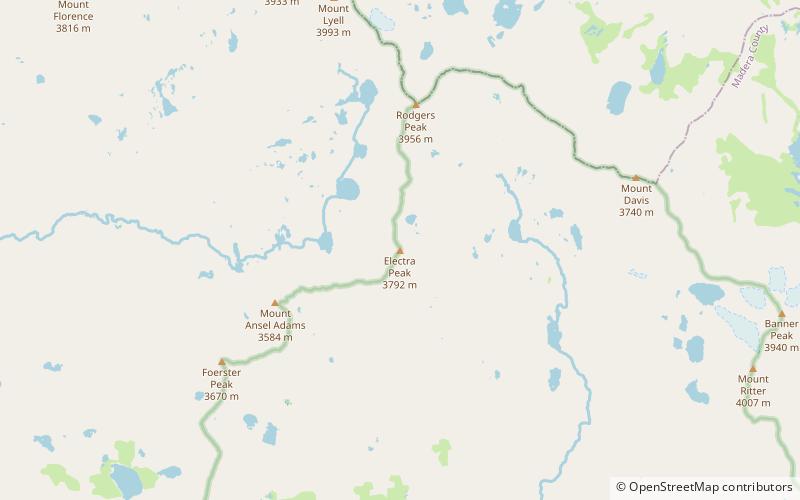
106 min walk • Mount Lyell is the highest point in Yosemite National Park, at 13,114 feet. It is located at the southeast end of the Cathedral Range, 1.2 miles northwest of Rodgers Peak.
 Mountain
Simmons Peak, Yosemite National Park
144 min walk • Simmons Peak is a mountain, in the Tuolumne Meadows region of Yosemite National Park. In difficulty, its routes range from scrambling to class 4. It is a few miles north of Mount Lyell.
 Nature, Natural attraction, Mountain
Mount Ritter, Ansel Adams Wilderness
117 min walk • Mount Ritter is the highest mountain in Madera County, California, in the Western United States, at an elevation of 13,149 feet.
 Natural attraction, Nature, Mountain
Triple Divide Peak, Yosemite National Park
149 min walk • Triple Divide Peak is a mountain on the boundary between Yosemite National Park and the Ansel Adams Wilderness in Madera County, California. It is located 0.7 miles north of Walton Lake and 1.3 miles southeast of Merced Peak.
 Mountain
Electra Peak, Yosemite National Park
54 min walk • Electra Peak is a mountain, broadly in the Tuolumne Meadows area of Yosemite National Park, if far, from the road. Electra Peak is the 14th highest mountain in Yosemite National Park. Electra Peak may have been named for a play called Electra.
 Natural attraction, Mountain, Park
Cathedral Range, Yosemite National Park
106 min walk • The Cathedral Range is a mountain range immediately to the south of Tuolumne Meadows in Yosemite National Park. The range is an offshoot of the Sierra Nevada. The range is named after Cathedral Peak, which resembles a cathedral spire.
 Mountain
Mount Florence, Yosemite National Park
116 min walk • Mount Florence is a mountain, in the Tuolumne Meadows region of Yosemite National Park. Its easiest route is a class 2 scramble. Mount Florence is the tenth highest mountain in Yosemite.
 Nature, Natural attraction, Mountain
Mount Davis, Ansel Adams Wilderness
106 min walk • Mount Davis is a prominent peak in the Ansel Adams Wilderness on the Inyo National Forest and south of Yosemite National Park. The peak was named in honor of Lieutenant Milton Fennimore Davis, who was with the first troops detailed to guard Yosemite National Park.
 Natural attraction, Nature, Mountain
Mount Maclure, Yosemite National Park
112 min walk • Mount Maclure is the nearest neighbor to Mount Lyell, the highest point in Yosemite National Park. Mount Maclure is the fifth-highest mountain of Yosemite.


