Schuylkill River Park Community Garden, Philadelphia
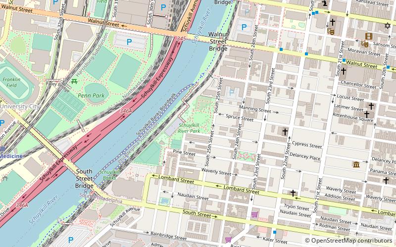
Map
Facts and practical information
The Schuylkill River Park Community Garden is a unique approximately 70 plot community garden located at 25th and Manning Streets in Philadelphia, Pennsylvania. The Garden is one of only a very few located on Fairmount Park land, part of Philadelphia's Park System. ()
Elevation: 16 ft a.s.l.Coordinates: 39°56'55"N, 75°10'55"W
Getting there by public transportation
Public transportation stops near this location
- Metro
- Bus
- Tram
- Train
 Metro
Metro
- Calculate routeWalnut St & 23rd St 7 min walk
- Calculate routeBolt Bus 14 min walk
- Calculate route30th Street 12 min walk
- Calculate route22nd Street 12 min walk
- Calculate route33rd Street 16 min walk
- Calculate route19th Street 17 min walk
- Calculate route30th Street 12 min walk
- Calculate route34th Street 19 min walk
- Calculate route15th-16th & Locust 21 min walk
- Calculate route15th Street 23 min walk
- Calculate routePenn Medicine 12 min walk
- Calculate routePhiladelphia 30th Street Station 13 min walk
- Calculate routeSuburban Station 22 min walk
Maps SEPTA Regional Rail
SEPTA Regional RailDay trips


Frequently Asked Questions (FAQ)
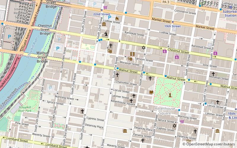
Which popular attractions are close to Schuylkill River Park Community Garden?
Nearby attractions include Schuylkill River Park, Philadelphia (1 min walk), Ramcat Historic District, Philadelphia (1 min walk), Fitler Square, Philadelphia (5 min walk), Walnut Street Bridge, Philadelphia (6 min walk).
How to get to Schuylkill River Park Community Garden by public transport?
The nearest stations to Schuylkill River Park Community Garden:
Bus
Tram
Metro
Train
Bus
- Walnut St & 23rd St • Lines: 12, 9 (7 min walk)
- Bolt Bus (14 min walk)
Tram
- 30th Street • Lines: 10, 11, 13, 34, 36 (12 min walk)
- 22nd Street • Lines: 10, 11, 13, 34, 36 (12 min walk)
Metro
- 30th Street • Lines: Mfl (12 min walk)
- 34th Street • Lines: Mfl (19 min walk)
Train
- Penn Medicine (12 min walk)
- Philadelphia 30th Street Station (13 min walk)