Magic Island, Honolulu
Map

Gallery

Facts and practical information
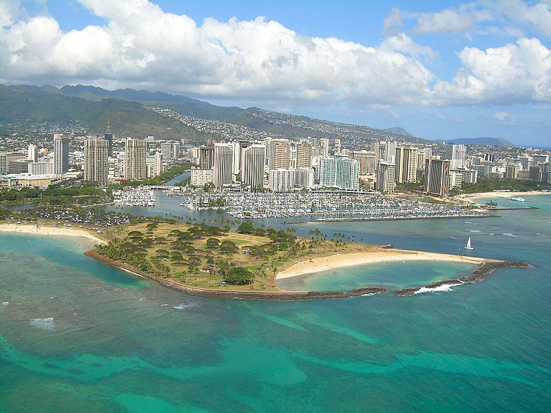
Magic Island is a small man-made peninsula in Honolulu, Hawaii, adjacent to Ala Moana Beach Park and the Ala Wai Yacht Harbor. It was created in 1964 as the site of a resort complex, but was subsequently converted to a park. The name was changed to "Aina Moana," but the new name is used infrequently. ()
Elevation: 23 ft a.s.l.Coordinates: 21°17'5"N, 157°50'49"W
Address
Ala Moana - KakaakoHonolulu
ContactAdd
Social media
Add
Day trips
Magic Island – popular in the area (distance from the attraction)
Nearby attractions include: Ala Moana Center, U.S. Army Museum of Hawaii, Neal S. Blaisdell Center, Ala Moana Beach Park.
Frequently Asked Questions (FAQ)
Which popular attractions are close to Magic Island?
Nearby attractions include Hawaii Shingon Mission, Honolulu (4 min walk), Ala Moana Beach Park, Honolulu (8 min walk), Ala Wai Harbor, Honolulu (9 min walk), Duke Paoa Kahanamoku Lagoon, Honolulu (12 min walk).
How to get to Magic Island by public transport?
The nearest stations to Magic Island:
Bus
Bus
- Ala Moana Boulevard + Ala Moana Center • Lines: 19, 20, 23, 42, 56, 57, 57A, 6, 60, 65, 8, 88A, 98A, E (11 min walk)
- Ala Moana Bl + Opposite Atkinson Drive • Lines: 19, 20, 23, 42, 8, 98A, E (13 min walk)


