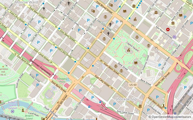
Main Street Banking Historic District, Richmond
Map
Facts and practical information
The Main Street Banking Historic District is a national historic district located in downtown Richmond, Virginia. The district encompasses 19 contributing buildings located south of the Virginia State Capitol and west of the Shockoe Slip Historic District. It is the location of a number of buildings built for or occupied by banking institutions. The district includes representative examples of the Late Victorian and International Style architecture built between about 1865 and 1965. Notable buildings include the Virginia Employment Commission Building, the 700 Building, the Ross Building, the Fidelity Building. Located in the district is the separately listed First National Bank Building. ()
Built: 1865 (161 years ago)Area: 13 acres (0.0203 mi²)Coordinates: 37°32'17"N, 77°26'11"W
Address
Downtown Richmond (Central Office)Richmond
ContactAdd
Social media
Add
Getting there by public transportation
Public transportation stops near this location
- Bus
- Train
 Bus
Bus
- Calculate routeA 9 min walk
- Calculate routeB 9 min walk
- Calculate routeC 9 min walk
- Calculate routeD 10 min walk
- Calculate routeRichmond Main Street 12 min walk
Day trips


Frequently Asked Questions (FAQ)
Which popular attractions are close to Main Street Banking Historic District?
Nearby attractions include First National Bank Building, Richmond (1 min walk), Deep Run Baptist Church, Richmond (3 min walk), Stewart-Lee House, Richmond (4 min walk), Lewis F. Powell, Richmond (4 min walk).
How to get to Main Street Banking Historic District by public transport?
The nearest stations to Main Street Banking Historic District:
Bus
Train
Bus
- A • Lines: 1A, 1C (9 min walk)
- B • Lines: 1A, 1C (9 min walk)
Train
- Richmond Main Street (12 min walk)