The Paramount, San Francisco

Gallery (1)
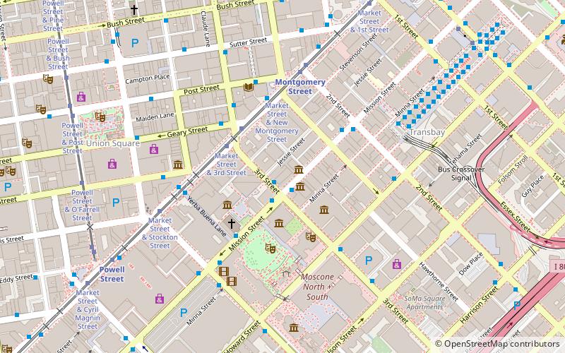
Map
Map
Facts and practical information
The Paramount, or 680 Mission Street at Third, is a 40-story rental-apartment tower that is located South of Market just outside the Financial District on Mission Street in San Francisco. ()
Opened: 2002 (24 years ago)Floors: 40Coordinates: 37°47'12"N, 122°24'7"W
Address
680;688;690;692 Mission StreetSoutheast San Francisco (South Beach)San Francisco
Contact
Social media
Add
Getting there by public transportation
Public transportation stops near this location
- Metro
- Bus
- Trolleybus
- Tram
- Light rail
- Train
- Ferry
 Metro
Metro
- Calculate route3rd Street & Mission Street 1 min walk
- Calculate routeMission Street & 3rd Street 2 min walk
- Calculate routeMarket Street & 3rd Street 3 min walk
- Calculate routeMarket Street & Montgomery Street 4 min walk
- Calculate route3rd Street & Mission Street 1 min walk
- Calculate routeMission Street & 3rd Street 1 min walk
- Calculate routeKearny Street & Geary Street 4 min walk
- Calculate routeMarket Street & Kearny Street 3 min walk
- Calculate routeMontgomery Street 5 min walk
- Calculate routePowell Street 9 min walk
- Calculate routeEmbarcadero 13 min walk
- Calculate routeFolsom 19 min walk
- Calculate routeMontgomery Street 5 min walk
- Calculate routePowell Street 9 min walk
- Calculate routeEmbarcadero 13 min walk
- Calculate routeSan Francisco 4th & King Street 21 min walk
- Calculate routeFerry Building Gate G 21 min walk
Maps Muni Metro
Muni MetroDay trips


Frequently Asked Questions (FAQ)
Which popular attractions are close to The Paramount?
Nearby attractions include California Historical Society, San Francisco (1 min walk), Palace Hotel Residential Tower, San Francisco (2 min walk), Museum of the African Diaspora, San Francisco (2 min walk), New Montgomery Street, San Francisco (2 min walk).
How to get to The Paramount by public transport?
The nearest stations to The Paramount:
Bus
Trolleybus
Tram
Light rail
Metro
Train
Ferry
Bus
- 3rd Street & Mission Street • Lines: 15, 30, 8, 91 (1 min walk)
- Mission Street & 3rd Street • Lines: 101, 101X, 14R, 292, 30, 397, 398, 70, Fcx (2 min walk)
Trolleybus
- 3rd Street & Mission Street • Lines: 30, 45 (1 min walk)
- Mission Street & 3rd Street • Lines: 14 (1 min walk)
Tram
- Market Street & Kearny Street • Lines: F (3 min walk)
Light rail
- Montgomery Street • Lines: K, N, S, T (5 min walk)
- Powell Street • Lines: K, N, S, T (9 min walk)
Metro
- Montgomery Street • Lines: Blue, Green, Red, Yellow (5 min walk)
- Powell Street • Lines: Blue, Green, Red, Yellow (9 min walk)
Train
- San Francisco 4th & King Street (21 min walk)
Ferry
- Ferry Building Gate G • Lines: San Francisco Bay Ferry (21 min walk)