Burlingame State Park
#5764 among destinations in the United States
![Burlingame State Park location map](https://tzmedia.b-cdn.net/media/images/static-maps/us/41_3842_-71_7008.jpg)
Facts and practical information
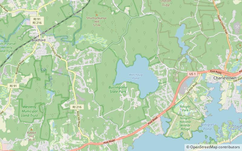
Burlingame State Park and Campground is a public recreation area located in the town of Charlestown, Rhode Island. The state park's 3,100 acres offer camping, hiking, and water activities on Watchaug Pond. ()
Burlingame State Park plan & book
Unleash the traveler in you — discover the cheapest flight deals, find the perfect hotel or hostel nearby, and search for the best car rental prices. Travel at your own pace to discover new places and enjoy your journey.
Burlingame State Park – popular in the area (distance from the attraction)
Nearby attractions include: Bradford, Frosty Drew Observatory, Ninigret Pond, Fort Ninigret.
2.7 miNWLocalityBradford
68 min walk • Bradford is a census-designated place and historic district in the towns of Westerly and Hopkinton in Washington County, Rhode Island, United States. The population was 1,406 at the 2010 census.
2.3 miSEMuseum, Observatories and planetariumsFrosty Drew Observatory, Charlestown
58 min walk • Frosty Drew Observatory is an educational astronomical observatory owned and operated by the Frosty Drew Memorial Fund. It is located in the Ninigret National Wildlife Refuge in Charlestown, Rhode Island midway along the coast line between Westerly and Point Judith. It is named after Edwin "Frosty" Drew.
2.8 miENature, Natural attraction, LakeNinigret Pond, Charlestown
73 min walk • Ninigret is a coastal lagoon in Charlestown, Rhode Island, in the United States, located at 41°22′45″N 71°38′43″W. It is the largest of the nine lagoons, or "salt ponds", in southern Rhode Island.
2.7 miEForts and castlesFort Ninigret, Charlestown
70 min walk • Fort Ninigret is a historic fort and trading post site at Fort Neck Road in Charlestown, Rhode Island, built and occupied by European settlers in the seventeenth century.
2.9 miSNational parkNinigret National Wildlife Refuge
74 min walk • The Ninigret National Wildlife Refuge is a National Wildlife Refuge situated along the shore of Ninigret Pond. It is characterized by salt marshes, kettle ponds, freshwater wetlands, maritime shrub lands, and forests, and it is seasonally inhabited by over 250 species of birds.
4.3 miWNature, Natural attraction, Protected areaEll Pond
109 min walk • Ell Pond is a kettle hole in Hopkinton, Washington County, Rhode Island. It is surrounded by a swamp of red maple and Atlantic white cypress, and by steep granitic monadnocks. The small area contains communities of both hydrophytic and xeric plants, which makes it ideal for ecological research and education.
3.7 miSENature, Natural attraction, Protected areaCharlestown Breachway State Beach
95 min walk • Charlestown Breachway State Beach is a seaside public recreation area on Block Island Sound in the town of Charlestown, Rhode Island.
5.6 miWNeighbourhoodMain Street Historic District, Westerly
142 min walk • The Main Street Historic District of Westerly, Rhode Island, encompasses a predominantly residential section of Main Street and adjoining Maple Avenue and School Street.
3.6 miNVillageWood River Junction
92 min walk • Wood River Junction is a small village in the town of Richmond, Rhode Island in the United States. It is home to the Chariho school district's main campus and is otherwise largely turf farms.
3.1 miE 5.7 miSWNature, Natural attraction, LakeWinnapaug Pond, Westerly
147 min walk • Winnapaug Pond is a breached saltwater lagoon in Westerly, Rhode Island, United States, connected to Block Island Sound by the Weekapaug Breachway, which was constructed during the mid-1950s.