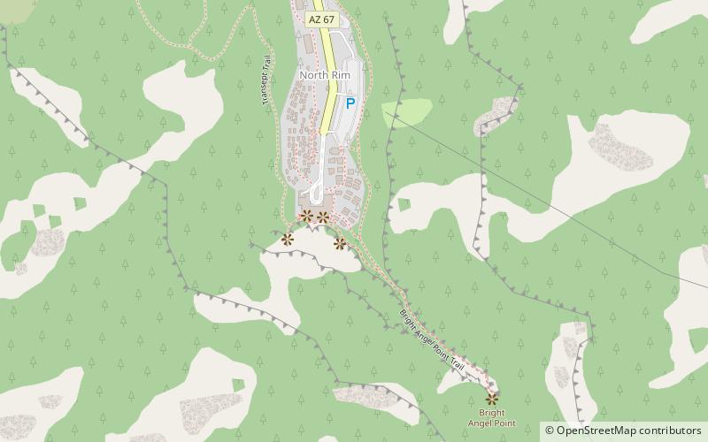
Bright Angel Point Trail, Grand Canyon National Park
#22 among attractions in Grand Canyon National Park

Facts and practical information
The Bright Angel Point Trail is a hiking trail located on the North Rim of the Grand Canyon National Park, located in the U.S. state of Arizona. ()
Grand Canyon National Park United States
Grand Canyon National Park plan & book
Unleash the traveler in you — discover the cheapest flight deals, find the perfect hotel or hostel nearby, and search for the best car rental prices. Travel at your own pace to discover new places and enjoy your journey.
Bright Angel Point Trail – popular in the area (distance from the attraction)
Nearby attractions include: North Kaibab Trail, Zoroaster Temple, Mount Hayden, Cheops Pyramid.
 Hiking, Hiking trail, Vernacular architecture
North Kaibab Trail, Grand Canyon National Park
36 min walk • The North Kaibab Trail is a hiking trail in the North Rim side of the Grand Canyon, in Grand Canyon National Park, located in the U.S. state of Arizona.
 Mountain
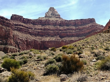
Zoroaster Temple, Grand Canyon National Park
139 min walk • Zoroaster Temple is a 7,123-foot-elevation summit located in the Grand Canyon, in Coconino County of Arizona, USA. It is situated 5.5 miles northeast of the Yavapai Point overlook on the canyon's South Rim, from which it can be seen towering over 4,600 feet above the Colorado River and Granite Gorge.
 Mountain
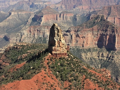
Mount Hayden, Grand Canyon National Park
178 min walk • Mount Hayden is an 8,362-foot-elevation summit located in the Grand Canyon, in Coconino County of Arizona, United States. It is situated one-half mile southeast of the Point Imperial viewpoint, on the canyon's North Rim, where it towers 5,000 feet above the bottom of Nankoweap Canyon.
 Mountain
Cheops Pyramid, Grand Canyon National Park
167 min walk • Cheops Pyramid is a 5,401-foot-elevation summit located in the Grand Canyon, in Coconino County of Arizona, US. This butte is situated four miles north of Grand Canyon Village, 2.5 miles south-southwest of Buddha Temple, and 1.7 mile south-southeast of Isis Temple, which is the nearest higher neighbor.
 Mountain
Brady Peak, Grand Canyon National Park
150 min walk • Brady Peak is an 8,121-foot-elevation summit located in the Grand Canyon, in Coconino County of northern Arizona, United States.
 Butte
ButteHancock Butte, Grand Canyon National Park
158 min walk • Hancock Butte is a 7,683-foot-elevation summit located in the Grand Canyon, in Coconino County of northern Arizona, US. It is situated one mile south of the Point Imperial viewpoint on the canyon's North Rim, where it towers 3,700 feet above Nankoweap Canyon.
 Mountain
Deva Temple, Grand Canyon National Park
85 min walk • Deva Temple is a 7,353-foot-elevation summit located in the Grand Canyon, in Coconino County of northern Arizona, USA. It is situated three miles south of the North Rim's Bright Angel Point, and towers 3,700 feet above Bright Angel Canyon.
 Lake
LakeGreenland Lake, Grand Canyon National Park
118 min walk • Greenland Lake is a small, intermittent lake of northern Arizona, located at the north neck of the Walhalla Plateau, in the northeast Grand Canyon.
 Mountain
Thor Temple, Grand Canyon National Park
155 min walk • Thor Temple is a 6,741-foot-elevation summit located in the Grand Canyon, in Coconino County of northern Arizona, United States.
 Campsite
North Rim Campground, Grand Canyon National Park
27 min walk • The Grand Canyon Inn and Campground, also known as the North Rim Inn, were built by the William W. Wylie and the Utah Parks Company as inexpensive tourist accommodations on the North Rim of the Grand Canyon, in Grand Canyon National Park.
 Butte
ButteKibbey Butte, Grand Canyon National Park
139 min walk • Kibbey Butte is a 7,801-foot-elevation summit located in the Grand Canyon, in Coconino County of northern Arizona, US. It is situated two miles south of the Point Imperial viewpoint on the canyon's North Rim, where it towers over 3,000 feet above Nankoweap Canyon.


