Cedar River Trail, Renton
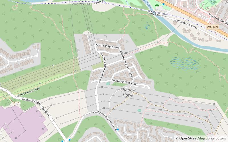
Map
Facts and practical information
The Cedar River Regional Trail is a partially paved 17.3-mile rail trail in Washington. The Cedar River Trail was the former mainline of the Milwaukee Road. ()
Elevation: 262 ft a.s.l.Coordinates: 47°28'20"N, 122°10'48"W
Address
Renton
ContactAdd
Social media
Add
Getting there by public transportation
Public transportation stops near this location
- Bus
 Bus
Bus
- Calculate routeRoyal Hills Dr SE & Lake Youngs Way SE 8 min walk
- Calculate routePuget Dr SE & Royal Hills Dr SE 13 min walk
- Calculate routeEdmonds Ave SE & SE 16th St 15 min walk
Day trips


Frequently Asked Questions (FAQ)
How to get to Cedar River Trail by public transport?
The nearest stations to Cedar River Trail:
Bus
Bus
- Royal Hills Dr SE & Lake Youngs Way SE • Lines: 148 (8 min walk)
- Puget Dr SE & Royal Hills Dr SE • Lines: 102, 148 (13 min walk)