Memorial Stadium, Asheville
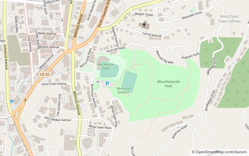
Map
Facts and practical information
Memorial Stadium is a multi-use stadium located in Asheville, North Carolina. The stadium was completed in 1925 to serve as a regional athletic and special events facility. Memorial Stadium is not to be confused with the similarly named Asheville High School Memorial Stadium. ()
Opened: 1925 (101 years ago)Capacity: 5000Coordinates: 35°35'12"N, 82°32'54"W
Address
32 Buchanan Pl.East End - Valley StreetAsheville 28801
ContactAdd
Social media
Add
Getting there by public transportation
Public transportation stops near this location
- Bus
 Bus
Bus
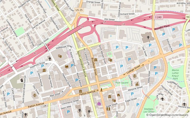
- Calculate routeAsheville Transit Center 16 min walk
- Calculate routeAsheville Bus Station 27 min walk
Day trips


Frequently Asked Questions (FAQ)
Which popular attractions are close to Memorial Stadium?
Nearby attractions include McCormick Field, Asheville (2 min walk), Building at 130–132 Biltmore Avenue, Asheville (8 min walk), George A. Mears House, Asheville (8 min walk), St. Matthias Episcopal Church, Asheville (9 min walk).
How to get to Memorial Stadium by public transport?
The nearest stations to Memorial Stadium:
Bus
Bus
- Asheville Transit Center (16 min walk)
- Asheville Bus Station (27 min walk)