Sampas Pavilion, Lowell
Facts and practical information
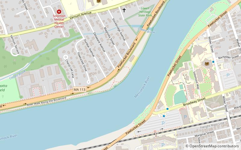
Sampas Pavilion is an outdoor amphitheater located in the Pawtucketville neighborhood of Lowell, Massachusetts along the Pawtucket Boulevard, 25 miles northwest of Boston, Massachusetts, United States and owned by the state of Massachusetts. The pavilion is located on the banks of the Merrimack River and is part of Lowell Heritage State Park. The seating capacity is approximately 1,000, consisting of general admission lawn seats and additional seating in the back. The venue has been in use since the early 1970s and has been used for events such as musical performances, ethnic festivals, and political rallies. The pavilion hosts a summer concert series, motorcycle rallies, and the city of Lowell's Fourth of July fireworks. ()
Lowell (Pawtucketville)Lowell
- Bus
 Bus
Bus
- Calculate routeUMASS South Parking Lot 6 min walk
- Calculate routeRiverview Suites 6 min walk
- Calculate routeSouth Campus 9 min walk
- Calculate routeLowell General Hospital 10 min walk


Frequently Asked Questions (FAQ)
Which popular attractions are close to Sampas Pavilion?
How to get to Sampas Pavilion by public transport?
Bus
- UMASS South Parking Lot • Lines: 6 (6 min walk)
- Riverview Suites • Lines: Blue Line, Downtown Express, Drum Hill Line, Red Line (N&W) (6 min walk)