Meier's Wine Cellars, Cincinnati
Facts and practical information
Meier's Wine Cellars is a winery in Silverton, Ohio. The company began in 1895 as the John C. Meier Grape Juice Company, Inc. and bottled juice from grapes grown in what is now the Kenwood Towne Centre. Drawn by the presence of the Baltimore and Ohio Railroad, the company purchased land in Silverton and began making wine in addition to juice. The company became the largest winery in Ohio. In 1976 the winery was purchased by Paramount Distillers, which retained the Meier's name and kept members of the Meier family as consultants. In 1980 the company acquired Lonz Wines, a winery on Middle Bass Island, one of the last places in Ohio where grapes were still grown. Today the company continues producing 45 kinds of wine and grape juices. ()
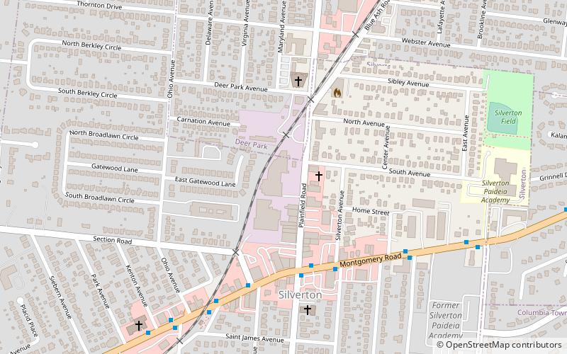
6955 Plainfield RdSilvertonCincinnati 45236-3733
- Bus
 Bus
Bus
- Calculate routeMontgomery Rd & Plainfield Rd 4 min walk
- Calculate routePlainfield Rd & Montgomery Rd 5 min walk


Frequently Asked Questions (FAQ)
When is Meier's Wine Cellars open?
- Monday closed
- Tuesday 9 am - 5 pm
- Wednesday 9 am - 5 pm
- Thursday 9 am - 5 pm
- Friday 9 am - 5 pm
- Saturday 9 am - 5 pm
- Sunday closed
How to get to Meier's Wine Cellars by public transport?
Bus
- Montgomery Rd & Plainfield Rd • Lines: 4 (4 min walk)
- Plainfield Rd & Montgomery Rd • Lines: 4 (5 min walk)