National Car Rental Field, St. Louis
Map
Facts and practical information
National Car Rental Field was a proposed multipurpose stadium in St. Louis, Missouri. It was proposed to become the home of St. Louis Rams of the National Football League before their move back to the Greater Los Angeles Area to play at SoFi Stadium in Inglewood, California was announced. The stadium cost was estimated at $1.1 billion. ()
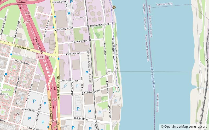
Capacity: 62.1 thous.Coordinates: 38°38'20"N, 90°10'55"W
Getting there by public transportation
Public transportation stops near this location
- Bus
- Light rail
- Train
 Bus
Bus
- Calculate routeLaclede's Landing 17 min walk
- Calculate routeConvention Center 19 min walk
- Calculate routeEast Riverfront 22 min walk
- Calculate route8th & Pine 25 min walk
- Calculate routeS 37 min walk
- Calculate routeR 37 min walk
- Calculate routeO 37 min walk
- Calculate routeP 37 min walk
- Calculate routeSaint Louis 40 min walk
Day trips


Frequently Asked Questions (FAQ)
Which popular attractions are close to National Car Rental Field?
Nearby attractions include The Bottle District, East St. Louis (10 min walk), Stan Musial Veterans Memorial Bridge, St. Louis (11 min walk), Lumière Place, St. Louis (12 min walk), Columbus Square, St. Louis (13 min walk).
How to get to National Car Rental Field by public transport?
The nearest stations to National Car Rental Field:
Light rail
Bus
Train
Light rail
- Laclede's Landing • Lines: Blue, Red (17 min walk)
- Convention Center • Lines: Blue, Red (19 min walk)
Bus
- S • Lines: 4 (37 min walk)
- R • Lines: 41 (37 min walk)
Train
- Saint Louis (40 min walk)