Woodlands Garden, Atlanta
Map
Facts and practical information
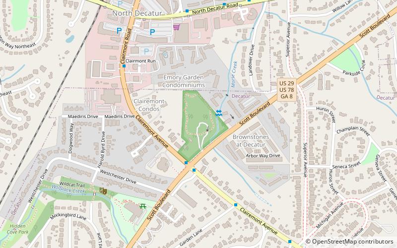
Woodlands Garden is an eight acre mostly-wooded public garden located in Decatur, Georgia. The Garden's mission is to preserve a woodland garden as an urban sanctuary to educate and engage the community in the natural world. This public greenspace serves as a native plant habitat for the Georgia Piedmont region, with over 30 species of trees. Ferns, wildflowers, vines, and shrubs are common features of the diverse plant collection. The Garden became a protected greenspace in 2002, when it was donated by the Morse family to become publicly accessible. The property has been influenced by landscape architect Edward L. Daugherty, among others. ()
Created: 2002Elevation: 981 ft a.s.l.Coordinates: 33°47'11"N, 84°18'13"W
Getting there by public transportation
Public transportation stops near this location
- Metro
- Bus
 Metro
Metro
- Calculate routeClairemont-Scott 3 min walk
- Calculate routeNorth Decatur - McDonalds 9 min walk
- Calculate routeNorth Decatur - Kinkos 9 min walk
- Calculate routeDecatur 24 min walk
Day trips


Frequently Asked Questions (FAQ)
Which popular attractions are close to Woodlands Garden?
Nearby attractions include Ridgeland Park, Atlanta (16 min walk), First Christian Church of Decatur, Atlanta (20 min walk), Emory Highlands, Atlanta (21 min walk), Decatur Cemetery, Atlanta (21 min walk).
How to get to Woodlands Garden by public transport?
The nearest stations to Woodlands Garden:
Bus
Metro
Bus
- Clairemont-Scott • Lines: 19, Cctma (3 min walk)
- North Decatur - McDonalds • Lines: Cctma (9 min walk)
Metro
- Decatur • Lines: Blue (24 min walk)