LoCicero Triangle, New York City
Map
Facts and practical information
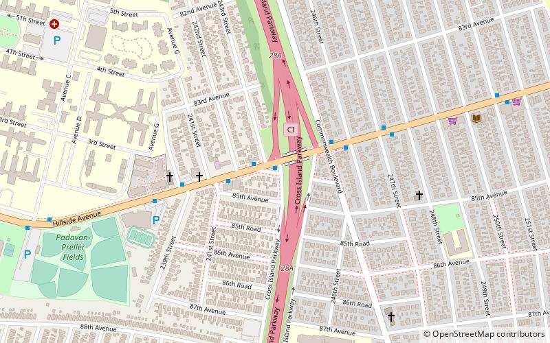
Frank P. LoCicero Triangle is a 250-square-foot triangular public green space located in the Bellerose neighborhood of Queens, New York. It is named in honor of local resident Frank P. LoCicero who lived in the area from 1950 until his death. In the years between, LoCicero was an active member and later president of the Bellerose Hillside Civic Association, which fought to maintain the suburban character of the neighborhood. ()
Elevation: 98 ft a.s.l.Coordinates: 40°44'2"N, 73°43'24"W
Address
Northeastern Queens (Bellerose)New York City
ContactAdd
Social media
Add
Getting there by public transportation
Public transportation stops near this location
- Train
 Train
Train
- Calculate routeBellerose 23 min walk
- Calculate routeElmont 25 min walk
- Calculate routeFloral Park 29 min walk
- Calculate routeQueens Village 34 min walk
Maps SubwayMaps
 Manhattan Buses
SubwayMapsManhattan BusesDay trips


Frequently Asked Questions (FAQ)
Which popular attractions are close to LoCicero Triangle?
Nearby attractions include The Living Museum, New York City (10 min walk), Little Neck Parkway, New York City (14 min walk), Bellerose Village Municipal Complex, Floral Park (22 min walk).
How to get to LoCicero Triangle by public transport?
The nearest stations to LoCicero Triangle:
Train
Train
- Bellerose (23 min walk)
- Elmont (25 min walk)