23rd Street viaduct, Kansas City
Facts and practical information
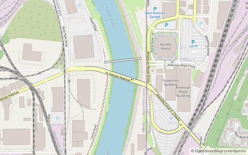
The 23rd Street viaduct is an automobile crossing of the Kansas River, and south of the Rock Island Bridge. It was built in 1921, and rebuilt in 2007. It is an elevated deck truss, and about 3,000 feet long. It survived the 1951, and 1993 Kansas City floods. It has two side approaches, one to the south, one to the north, and rises above the south part of the West Bottoms, and the parking lot to Kemper Arena. Its real name is the Kansas Avenue Bridge, but, because the primary half of it is in Missouri, it is called the 23rd Street viaduct more than the Kansas Avenue Bridge. ()
West Kansas City (Armourdale)Kansas City
- Bus
 Bus
Bus
- Calculate route14th at Wyoming 16 min walk
- Calculate routeWyoming at 12th 19 min walk
- Calculate route12th at Liberty 20 min walk
- Calculate routeSummit at 20th 21 min walk
23rd Street viaduct – popular in the area (distance from the attraction)
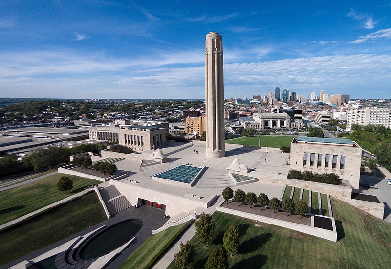
Nearby attractions include: National World War I Museum and Memorial, Municipal Auditorium, Kauffman Center for the Performing Arts, Barney Allis Plaza.


Frequently Asked Questions (FAQ)
Which popular attractions are close to 23rd Street viaduct?
How to get to 23rd Street viaduct by public transport?
Bus
- 14th at Wyoming • Lines: 9 (16 min walk)
- Wyoming at 12th • Lines: 9 (19 min walk)