Central Avenue Bridge, Kansas City
Map
Facts and practical information
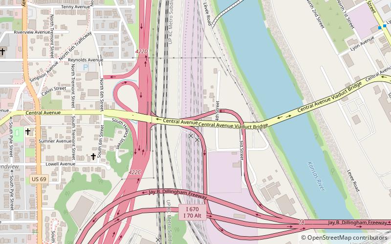
The Central Avenue Bridge is two level deck truss bridge over the Kansas River in Kansas City, Kansas. It was built in 1918, and rebuilt in 1984. It is just south of the Kansas City Southern Bridge, and north of the I-670 Viaduct over the Kansas River. ()
Opened: 1918 (108 years ago)Coordinates: 39°6'9"N, 94°37'9"W
Address
West Kansas City (Armourdale)Kansas City
ContactAdd
Social media
Add
Getting there by public transportation
Public transportation stops near this location
- Bus
 Bus
Bus
- Calculate routeWyoming at 12th 22 min walk
- Calculate route14th at Wyoming 23 min walk
- Calculate route12th at Liberty 24 min walk
Day trips


Frequently Asked Questions (FAQ)
Which popular attractions are close to Central Avenue Bridge?
Nearby attractions include Kansas City Southern Bridge, Kansas City (8 min walk), I-670 Viaduct, Kansas City (11 min walk), Missouri Pacific Bridge, Kansas City (13 min walk), Union Pacific Intermodal Bridge, Kansas City (13 min walk).
How to get to Central Avenue Bridge by public transport?
The nearest stations to Central Avenue Bridge:
Bus
Bus
- Wyoming at 12th • Lines: 9 (22 min walk)
- 14th at Wyoming • Lines: 9 (23 min walk)