Penn Quarter, Washington D.C.
Map
Gallery
Facts and practical information
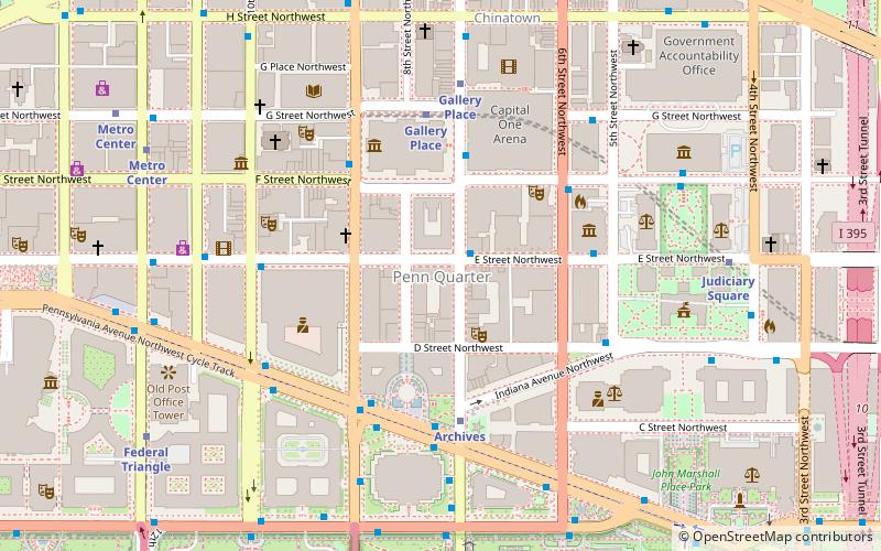
Penn Quarter is a neighborhood east of Downtown Washington, D.C. and north of Pennsylvania Avenue, NW. Penn Quarter is roughly equivalent to the city's early downtown core near Pennsylvania Avenue and 7th Street NW, The definition of Downtown Washington has expanded to include areas further to the west, such as the Golden Triangle, southern Dupont Circle and West End areas. ()
Coordinates: 38°53'45"N, 77°1'20"W
Address
Northwest Washington (Downtown-Penn Quarter-Chinatown)Washington D.C.
ContactAdd
Social media
Add
Day trips
Penn Quarter – popular in the area (distance from the attraction)
Nearby attractions include: National Portrait Gallery, Smithsonian American Art Museum, National Archives Building, Pennsylvania Avenue National Historic Site.
Frequently Asked Questions (FAQ)
Which popular attractions are close to Penn Quarter?
Nearby attractions include Harman Center for the Arts, Washington D.C. (1 min walk), National Museum of Crime and Punishment, Washington D.C. (2 min walk), Woolly Mammoth Theatre Company, Washington D.C. (2 min walk), International Spy Museum, Washington D.C. (3 min walk).
How to get to Penn Quarter by public transport?
The nearest stations to Penn Quarter:
Metro
Train
Bus
Tram
Metro
- Archives • Lines: Gr, Yl (4 min walk)
- Gallery Place • Lines: Gr, Rd, Yl (5 min walk)
Train
- L'Enfant (19 min walk)
- U.S. Capitol (22 min walk)
Bus
- Washington Deluxe Bus (22 min walk)
- Peter Pan Bus (22 min walk)
Tram
- Union Station • Lines: H Street/Benning Road Streetcar (26 min walk)
- H Street & 3rd Street Northeast • Lines: H Street/Benning Road Streetcar (30 min walk)


