University Field, El Paso
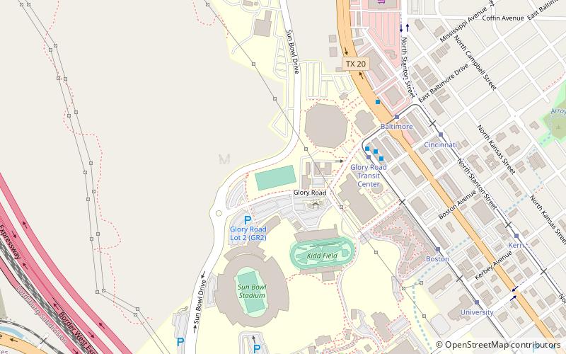
Map
Facts and practical information
University Field is the on-campus soccer stadium at the University of Texas at El Paso. ()
Coordinates: 31°46'35"N, 106°30'25"W
Address
Central El PasoEl Paso
ContactAdd
Social media
Add
Getting there by public transportation
Public transportation stops near this location
- Bus
- Tram
 Bus
Bus
- Calculate routeGlory Road Transit Center 4 min walk
- Calculate routeBaltimore 6 min walk
- Calculate routeCincinnati 8 min walk
- Calculate routeBoston 8 min walk
- Calculate routeBay E 5 min walk
- Calculate routeGlory Road Transit Center 5 min walk
- Calculate routeBay D 5 min walk
- Calculate routeHague 16 min walk
Day trips


Frequently Asked Questions (FAQ)
Which popular attractions are close to University Field?
Nearby attractions include Don Haskins Center, El Paso (3 min walk), Sun Bowl Stadium, El Paso (6 min walk), Stanlee and Gerald Rubin Center for the Visual Arts, El Paso (9 min walk), University of Texas at El Paso, El Paso (10 min walk).
How to get to University Field by public transport?
The nearest stations to University Field:
Tram
Bus
Tram
- Glory Road Transit Center • Lines: El Paso Streetcar (4 min walk)
- Baltimore • Lines: El Paso Streetcar (6 min walk)
Bus
- Bay E • Lines: 10, 14, 15, 70, Mesa Brio (5 min walk)
- Glory Road Transit Center (5 min walk)