Columbus Square, St. Louis
Map

Map

Facts and practical information
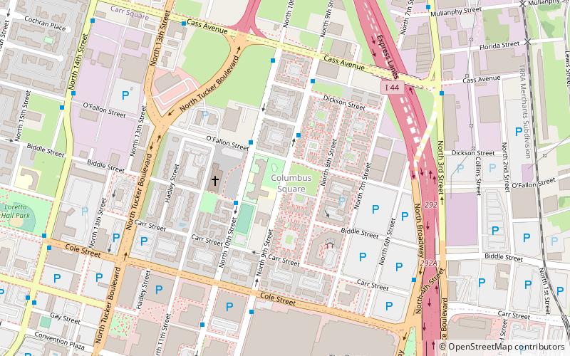
Columbus Square is a neighborhood of St. Louis, Missouri. It is bounded by Cass Avenue to the north, I-70 to the east, Tucker & North 13th Streets to the west, and Cole Street to the south. ()
Coordinates: 38°38'14"N, 90°11'26"W
Day trips
Columbus Square – popular in the area (distance from the attraction)
Nearby attractions include: Busch Stadium, Scottrade Center, The Dome at America's Center, City Museum.
Frequently Asked Questions (FAQ)
Which popular attractions are close to Columbus Square?
Nearby attractions include Shrine of St. Joseph, St. Louis (3 min walk), The Bottle District, East St. Louis (5 min walk), The Dome at America's Center, St. Louis (9 min walk), America's Center, St. Louis (9 min walk).
How to get to Columbus Square by public transport?
The nearest stations to Columbus Square:
Light rail
Bus
Train
Light rail
- Convention Center • Lines: Blue, Red (13 min walk)
- Laclede's Landing • Lines: Blue, Red (17 min walk)
Bus
- S • Lines: 4 (27 min walk)
- P • Lines: 174X (27 min walk)
Train
- Saint Louis (30 min walk)


