Covedale Center for the Performing Arts, Cincinnati
Map
Facts and practical information
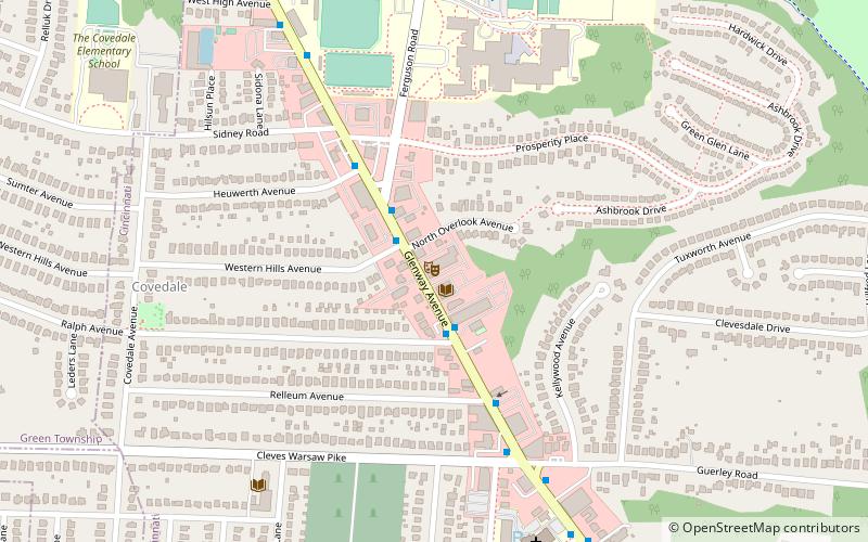
The Covedale Center for the Performing Arts is a live theater venue located at 4990 Glenway Avenue, Cincinnati, Ohio. The building was originally built by the Ackerman Family and opened as a cinema on March 21, 1947, with 924-seat movie house. In the 1970s a wall was erected down the middle to allow for a two-screen set-up. In 1998 the movie house was converted into a Cinema Grill, offering second-run movies and a dinner. That shut down a year later. The grill reopened in 2000 but went out of business again. The building was purchased by Cincinnati Young People's Theatre and opened on July 26, 2002, with the musical production "West Side Story". The theatre seats 392 people. ()
Coordinates: 39°7'17"N, 84°36'3"W
Address
4990 Glenway AveWest Price HillCincinnati 45238-3902
Contact
+1 513-241-6550
Social media
Add
Getting there by public transportation
Public transportation stops near this location
- Bus
 Bus
Bus
- Calculate routeGlenway Ave & North Overlook Ave 2 min walk
Day trips


Frequently Asked Questions (FAQ)
Which popular attractions are close to Covedale Center for the Performing Arts?
Nearby attractions include Union Baptist Cemetery, Cincinnati (9 min walk), Rapid Run Park, Cincinnati (18 min walk).
How to get to Covedale Center for the Performing Arts by public transport?
The nearest stations to Covedale Center for the Performing Arts:
Bus
Bus
- Glenway Ave & North Overlook Ave • Lines: 33 (2 min walk)