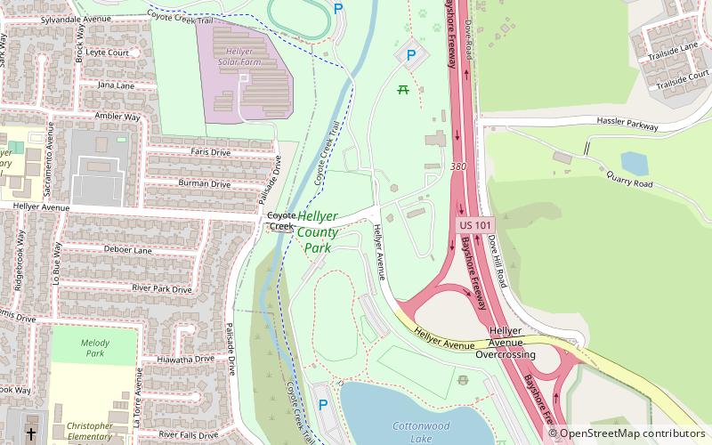
Hellyer County Park, San Jose
Map
Facts and practical information
Hellyer County Park is one of 28 Santa Clara County Parks. The park is located just off of Highway 101 in San Jose, California, United States. The 178-acre park is home to Hellyer Park Velodrome and Cottonwood Lake. Other recreational opportunities at the park include picnicking, hiking, fishing, biking, and a playground. Coyote Creek Parkway is a multi-use trail that is paved for 15 miles south to Anderson Lake County Park. Coyote Creek Parkway is a jurisdiction of the Santa Clara County Parks. Coyote Creek Trail continues to the north along Coyote Creek under the jurisdiction of San Jose city parks. ()
Elevation: 161 ft a.s.l.Coordinates: 37°17'3"N, 121°48'43"W
Getting there by public transportation
Public transportation stops near this location
- Bus
 Bus
Bus
- Calculate routeYerba Buena Road & Ambrose Court 14 min walk
Day trips


Frequently Asked Questions (FAQ)
How to get to Hellyer County Park by public transport?
The nearest stations to Hellyer County Park:
Bus
Bus
- Yerba Buena Road & Ambrose Court • Lines: 72 (14 min walk)