Trek Zone

Narragansett Bay National Estuarine Research Reserve, Hope Island

#1 among attractions in Hope Island

Top attraction, Natural attraction, Protected area
Narragansett Bay National Estuarine Research Reserve location map
Map

Facts and practical information
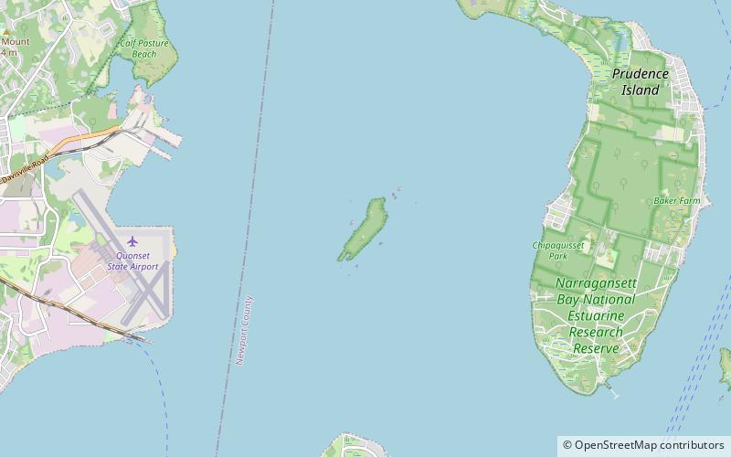
Established: 1980 (44 years ago)Coordinates: 41°36'8"N, 71°22'4"W
Address

Hope Island United States

ContactAdd
Social media
Add
Day trips

Narragansett Bay National Estuarine Research Reserve – popular in the area (distance from the attraction)

Nearby attractions include: Old Narragansett Church, Green Animals Topiary Garden, Seabee Museum, Smith's Castle.

  • old narragansett church north kingstown4.6 miSW
  • green animals topiary garden portsmouth4.8 miE
  • seabee museum north kingstown4.2 miW
  • smiths castle north kingstown4.7 miW
  • conanicut island light jamestown2 miS
  • quidnessett country club quonset point3.6 miNW
  • st pauls church north kingstown4.8 miSW
  • rhode island bay cruises north kingstown2.6 miSW
  • warwick country club5 miN
  • prudence island light portsmouth3.3 miE
  • poplar point light north kingstown location map
    4.3 miSW

Where to next? Visit rhode island Rhode Island region page or discover the top tourist attractions in United States.