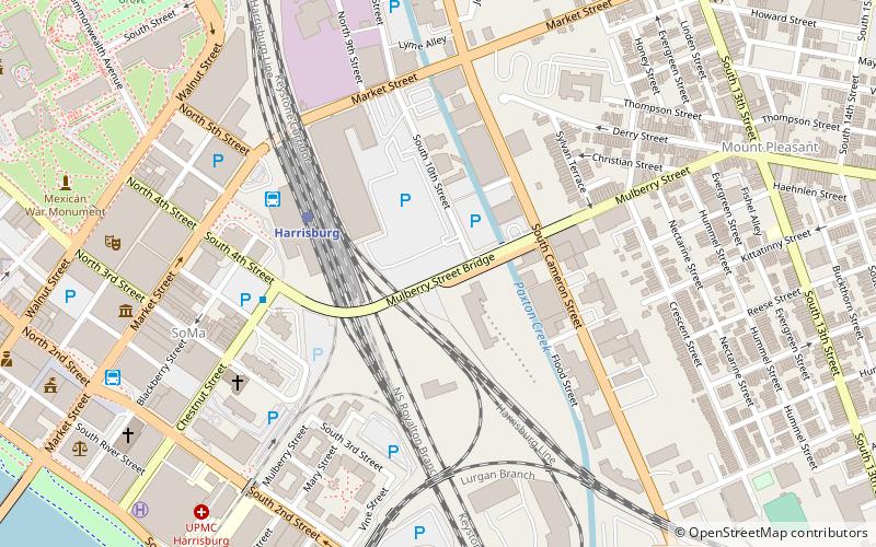
Mulberry Street Bridge, Harrisburg
Map
Facts and practical information
The Mulberry Street Bridge is a concrete arch bridge that spans Cameron Street and Paxton Creek in Harrisburg, Pennsylvania. The bridge is the second constructed at the current site to connect the Allison Hill neighborhood of East Harrisburg to Downtown. It replaced an iron and fire-prone, wood-decked structure erected in 1891, which was heralded as a unifier of a “Greater Harrisburg.” The concrete replacement bridge constructed in 1909, was a marvel at the time, and is eligible to be listed on the National Register of Historic Places. ()
Length: 584 ftWidth: 30 ftCoordinates: 40°15'41"N, 76°52'30"W
Getting there by public transportation
Public transportation stops near this location
- Bus
- Train
 Bus
Bus
- Calculate routeHarrisburg 4 min walk
- Calculate routeFlixBus Harrisburg 5 min walk
- Calculate routeHarrisburg 5 min walk
- Calculate routeMarket Street Transfer Station 9 min walk
Day trips
Mulberry Street Bridge – popular in the area (distance from the attraction)
Nearby attractions include: Pennsylvania State Capitol, Strawberry Square, Cathedral of Saint Patrick, Whitaker Center for Science and the Arts.


Frequently Asked Questions (FAQ)
Which popular attractions are close to Mulberry Street Bridge?
Nearby attractions include Salem United Church of Christ, Harrisburg (7 min walk), Camp Curtin Memorial Methodist Episcopal Church, Harrisburg (7 min walk), Old Downtown Harrisburg Commercial Historic District, Harrisburg (7 min walk), Harrisburg University of Science and Technology, Harrisburg (8 min walk).
How to get to Mulberry Street Bridge by public transport?
The nearest stations to Mulberry Street Bridge:
Train
Bus
Train
- Harrisburg (4 min walk)
Bus
- FlixBus Harrisburg • Lines: 2680 (5 min walk)
- Harrisburg (5 min walk)