Montopolis Bridge, Austin

Gallery (2)
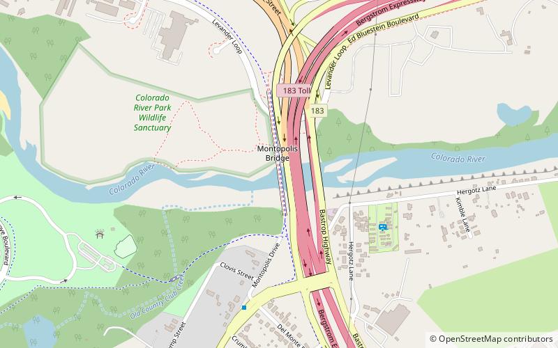
Map
Map
Gallery
Facts and practical information
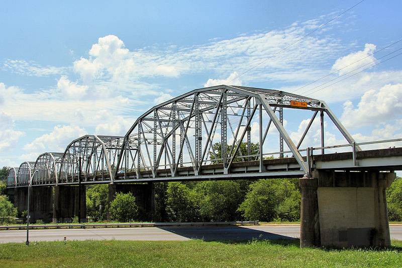
The Montopolis Bridge is a historic Parker through truss bridge in Austin, Texas. It is located in the Montopolis neighborhood where a bicycle and pedestrian walkway crosses the Colorado River in southeastern Travis County. The bridge consists of five 200-foot Parker through truss spans and four 52-foot steel I-beam approach spans resting on reinforced concrete abutments. It was added to the National Register of Historic Places on October 10, 1996. ()
Opened: 11 February 1938 (88 years ago)Length: 1221 ftWidth: 24 ftCoordinates: 30°14'44"N, 97°41'29"W
Getting there by public transportation
Public transportation stops near this location
- Bus
 Bus
Bus
- Calculate route302 Montopolis/Del Monte 7 min walk
- Calculate routeMontopolis/Walker 14 min walk
- Calculate routeEastside Bus Plaza Bay H 15 min walk
Day trips


Frequently Asked Questions (FAQ)
How to get to Montopolis Bridge by public transport?
The nearest stations to Montopolis Bridge:
Bus
Bus
- 302 Montopolis/Del Monte • Lines: 217 (7 min walk)
- Montopolis/Walker • Lines: 217 (14 min walk)