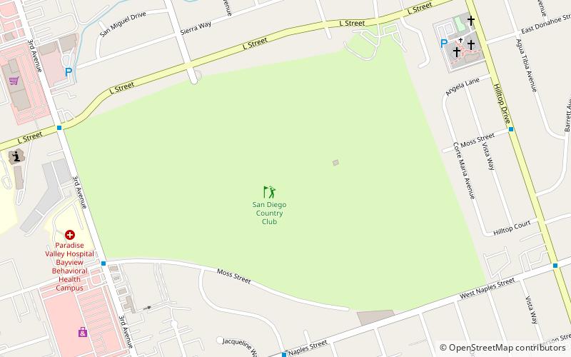
San Diego Country Club, Chula Vista
Map
Facts and practical information
The San Diego Country Club is a private golf club in Chula Vista, California. The club, which features an 18-hole golf course with a par of 72, was founded in 1897. ()
Coordinates: 32°37'9"N, 117°3'54"W
Address
West Chula Vista (Castle Park)Chula Vista
ContactAdd
Social media
Add
Getting there by public transportation
Public transportation stops near this location
- Bus
- Light rail
 Bus
Bus
- Calculate routePalomar Street Transit Center 42 min walk
- Calculate routePalomar Street 42 min walk
Day trips


Frequently Asked Questions (FAQ)
How to get to San Diego Country Club by public transport?
The nearest stations to San Diego Country Club:
Bus
Light rail
Bus
- Palomar Street Transit Center • Lines: 704, 712, 712L (42 min walk)
Light rail
- Palomar Street • Lines: 510 (42 min walk)