Central Christian Church, Indianapolis
Map
Facts and practical information
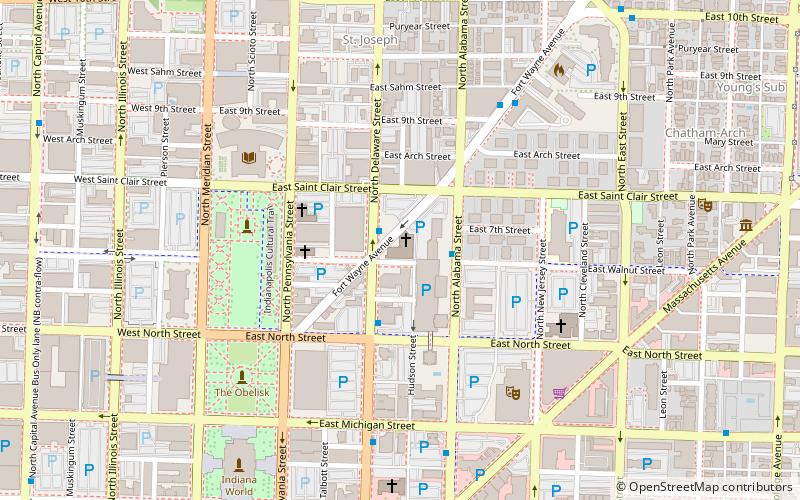
Central Christian Church, also known in its early years as the Church of Christ in Indianapolis and Christian Chapel, is located at 701 North Delaware Street in downtown Indianapolis, Indiana. Its members formally organized on June 12, 1833, as the city's first Christian Church congregation. The congregation formally adopted the name of Central Christian Church on February 3, 1879. Its red brick and stone masonry Romanesque Revival-style church was dedicated in 1893. Building additions were completed in 1913 and in 1922. The church continues to serve the Indianapolis community and holds weekly worship services. ()
Coordinates: 39°46'37"N, 86°9'13"W
Address
Downtown Indianapolis (St. Joseph Historic Neighborhood)Indianapolis
ContactAdd
Social media
Add
Getting there by public transportation
Public transportation stops near this location
- Bus
- Train
 Bus
Bus
- Calculate routeFlixBus Indianapolis 18 min walk
- Calculate routeJulia M. Carson Transit Center 18 min walk
- Calculate routeD 18 min walk
- Calculate routeC 19 min walk
- Calculate routeCanal 19 min walk
- Calculate routeMethodist 25 min walk
- Calculate routeIndianapolis Union Station 27 min walk
Day trips


Frequently Asked Questions (FAQ)
Which popular attractions are close to Central Christian Church?
Nearby attractions include YWCA Blue Triangle Residence Hall, Indianapolis (3 min walk), Mt. Pisgah Lutheran Church, Indianapolis (3 min walk), Riley Towers, Indianapolis (4 min walk), The Spink, Indianapolis (5 min walk).
How to get to Central Christian Church by public transport?
The nearest stations to Central Christian Church:
Bus
Train
Bus
- FlixBus Indianapolis • Lines: 2511 (18 min walk)
- Julia M. Carson Transit Center (18 min walk)
Train
- Canal (19 min walk)
- Methodist (25 min walk)