Cerro Grande, Valles Caldera

Gallery (1)
Map
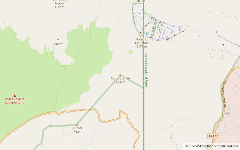
Map
Facts and practical information
Cerro Grande is a 10,207-foot summit on the rim of the Valles Caldera not far north of New Mexico State Road 4, the main highway through Los Alamos County. Like many mountains in the Jemez, Cerro Grande was mainly covered with coniferous forest, composed largely of ponderosa pine and aspen trees, with a characteristic rincon on its slopes on and south of the summit. ()
Elevation: 10207 ftProminence: 660 ftCoordinates: 35°52'10"N, 106°24'47"W
Address
Valles Caldera
ContactAdd
Social media
Add
Day trips