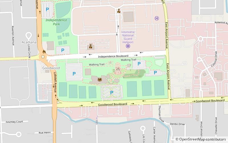
Independence Park Botanic Gardens, Baton Rouge
Map
Facts and practical information
The Independence Park Botanic Gardens are botanical gardens located in Independence Park at 7950 Independence Boulevard, Baton Rouge, Louisiana. They are open during daylight hours without admission fee. ()
Elevation: 46 ft a.s.l.Coordinates: 30°26'40"N, 91°6'22"W
Address
East Baton Rouge (Tara)Baton Rouge
ContactAdd
Social media
Add
Getting there by public transportation
Public transportation stops near this location
- Bus
 Bus
Bus
- Calculate routeCortana Mall Transit Hub 37 min walk
Day trips


Frequently Asked Questions (FAQ)
How to get to Independence Park Botanic Gardens by public transport?
The nearest stations to Independence Park Botanic Gardens:
Bus
Bus
- Cortana Mall Transit Hub (37 min walk)