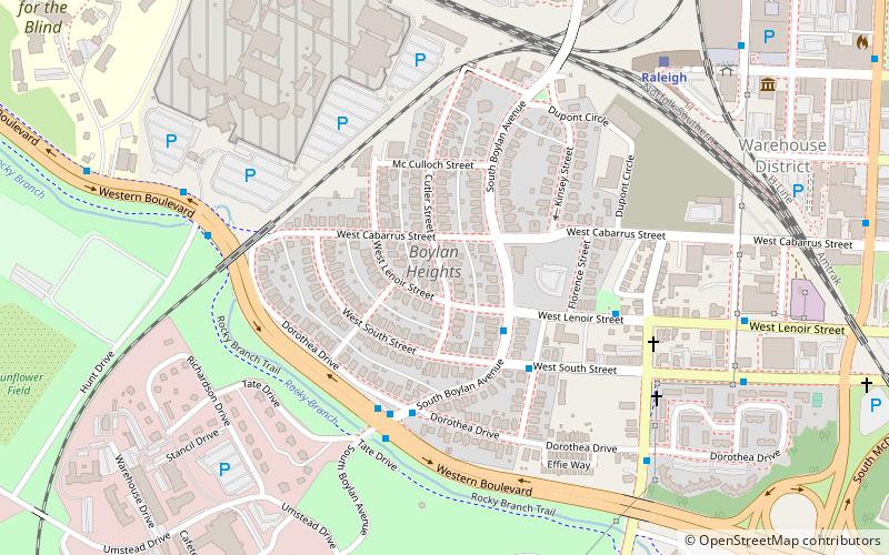
Boylan Heights, Raleigh

Gallery (1)
Map
Map
Facts and practical information
Boylan Heights is a historic neighborhood in Raleigh, North Carolina. It was added to the National Register of Historic Places as a historic district on July 29, 1985. It is also one of six local Historic Overlay Districts in Raleigh. ()
Built: 1907 (119 years ago)Area: 82 acres (0.1281 mi²)Coordinates: 35°46'26"N, 78°39'7"W
Getting there by public transportation
Public transportation stops near this location
- Bus
- Train
 Bus
Bus
- Calculate routeS Boylan Ave at W Lenoir St 3 min walk
- Calculate routeSouth St at Florence St 4 min walk
- Calculate routeWestern Boulevard & Boylan Avenue 5 min walk
- Calculate routeRaleigh 9 min walk
Day trips


Frequently Asked Questions (FAQ)
Which popular attractions are close to Boylan Heights?
Nearby attractions include Montfort Hall, Raleigh (5 min walk), Joel Lane Museum House, Raleigh (7 min walk), CAM Raleigh, Raleigh (11 min walk), Dix Hill, Raleigh (11 min walk).
How to get to Boylan Heights by public transport?
The nearest stations to Boylan Heights:
Bus
Train
Bus
- S Boylan Ave at W Lenoir St • Lines: 11 (3 min walk)
- South St at Florence St • Lines: 11 (4 min walk)
Train
- Raleigh (9 min walk)