Blue Mountain, Lake Tahoe Basin Management Unit
#41 among attractions in Lake Tahoe Basin Management Unit

Facts and practical information
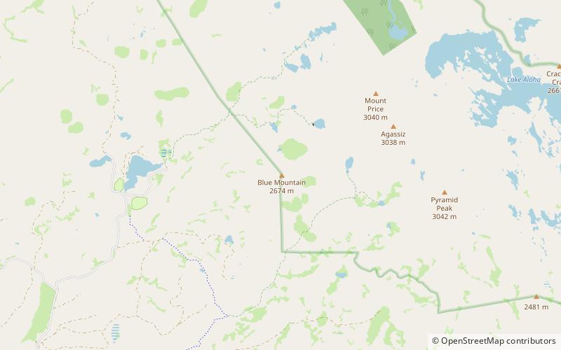
Blue Mountain is a mountain in the Crystal Range, a subrange of the Sierra Nevada. It is west of Lake Tahoe on the western boundary of the Desolation Wilderness in El Dorado County, California. ()
Lake Tahoe Basin Management Unit United States
Blue Mountain – popular in the area (distance from the attraction)
Nearby attractions include: Horsetail Falls, Mount Tallac, Wrights Lake, Waca Lake.
4.2 miENature, Natural attraction, WaterfallHorsetail Falls, Lake Tahoe Basin Management Unit
108 min walk • Horsetail Falls is a waterfall in the Sierra Nevada mountain range, to the west of Lake Tahoe in the Desolation Wilderness of El Dorado County, California, United States. It falls in stages for nearly 500ft. It can be reached by hiking north out of the Twin Bridges trailhead on U.S. Route 50.
6.7 miNENature, Natural attraction, View pointMount Tallac, Lake Tahoe Basin Management Unit
170 min walk • Mount Tallac is a mountain peak southwest of Lake Tahoe, in El Dorado County, California. The peak lies within the Desolation Wilderness in the Eldorado National Forest. It is quite visible from State Routes 89 and 28, and U.S. Route 50.
1.9 miWNature, Natural attraction, LakeWrights Lake, Eldorado National Forest
48 min walk • Wrights Lake is in the Sierra Nevada mountain range, west of Lake Tahoe on the western border of the Desolation Wilderness. It can be reached via Wrights Road off U.S. Route 50 and the Ice House Road.
3.1 miENature, Natural attraction, LakeWaca Lake, Lake Tahoe Basin Management Unit
79 min walk • Waca Lake is a backcountry lake in the Desolation Wilderness in the Sierra Nevada mountain range of California. It lies just south of Lake Aloha.
2.9 miNENature, Natural attraction, LakeLake Aloha, Lake Tahoe Basin Management Unit
75 min walk • Lake Aloha is a large shallow backcountry reservoir located at an elevation of 8,116 feet in the Sierra Nevada Range, west of Lake Tahoe in El Dorado County, in eastern California.
2.2 miENature, Natural attraction, MountainPyramid Peak, Lake Tahoe Basin Management Unit
56 min walk • Pyramid Peak is a mountain in the California's Sierra Nevada in the Crystal Range to the west of Lake Tahoe. It is the highest point in the Desolation Wilderness.
4.2 miENature, Natural attraction, LakeLake of the Woods, Lake Tahoe Basin Management Unit
109 min walk • The Lake of the Woods is a backcountry glacial lake in the Desolation Wilderness of the Eldorado National Forest, southwest of Lake Tahoe, in El Dorado County, California. It lies just southeast of Lake Aloha.
5.3 miENature, Natural attraction, MountainRalston Peak, Lake Tahoe Basin Management Unit
135 min walk • Ralston Peak is a mountain in the Sierra Nevada mountain range to the west of Lake Tahoe within the Desolation Wilderness in El Dorado County, California.
5.5 miNENature, Natural attraction, LakeGilmore Lake, Lake Tahoe Basin Management Unit
141 min walk • Gilmore Lake in California is a backcountry lake in the Sierra Nevada mountain range, to the west of Lake Tahoe in the Desolation Wilderness. It can be reached by hiking west out of the Glen Alpine Springs trailhead near the town of South Lake Tahoe. This lake offers great fishing for Lake trout.
4.8 miSENature, Natural attraction, RockLover's Leap, Eldorado National Forest
122 min walk • Lover's Leap is a steep granite cliff band in El Dorado County, California, United States, a landmark which catches the eye as one travels by, and a popular destination for climbers.
3.1 miENature, Natural attraction, LakePyramid Lake, Lake Tahoe Basin Management Unit
79 min walk • Pyramid Lake is a lake in the backcountry of the Desolation Wilderness in the Sierra Nevada Mountains of El Dorado County, California.