Sterrett Sub-District School, Pittsburgh
Map

Map

Facts and practical information
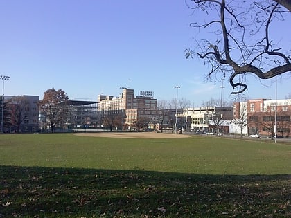
The Sterrett Sub-District School in the Point Breeze neighborhood of Pittsburgh, Pennsylvania, is a building from 1898. It was listed on the National Register of Historic Places in 1986. ()
Built: 1898 (128 years ago)Coordinates: 40°26'47"N, 79°54'21"W
Address
East End (Point Breeze)Pittsburgh
ContactAdd
Social media
Add
Day trips
Sterrett Sub-District School – popular in the area (distance from the attraction)
Nearby attractions include: Frick Art & Historical Center, Bakery Square, Tree of Life – Or L'Simcha Congregation, Frick Park.
Frequently Asked Questions (FAQ)
Which popular attractions are close to Sterrett Sub-District School?
Nearby attractions include Point Breeze, Pittsburgh (4 min walk), Frick Art & Historical Center, Pittsburgh (5 min walk), Killer Heels, Pittsburgh (5 min walk), Homewood Cemetery, Pittsburgh (9 min walk).
How to get to Sterrett Sub-District School by public transport?
The nearest stations to Sterrett Sub-District School:
Bus
Bus
- Homewood (15 min walk)
- Fifth Ave at Frankstown Ave • Lines: P10 (22 min walk)


