Traveler Buttress, Eldorado National Forest
#16 among attractions in Eldorado National Forest

Facts and practical information
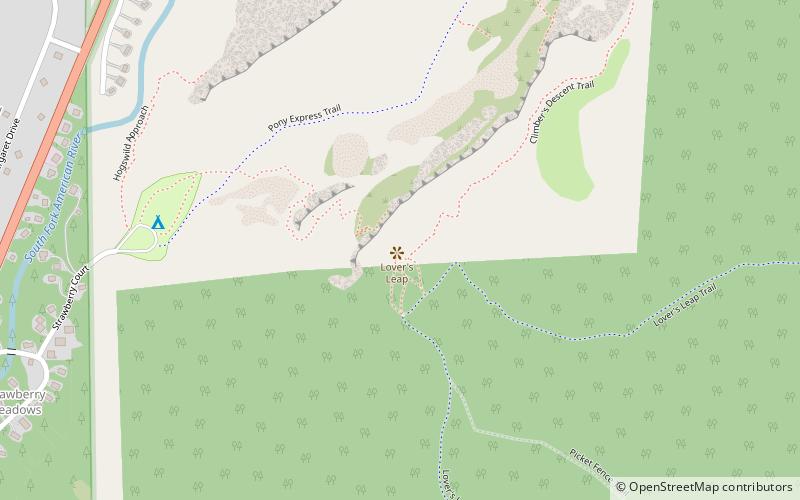
The Traveler Buttress is a technical rock climbing on Lover's Leap route near Tahoe, California, USA, and is featured in Fifty Classic Climbs of North America. ()
Eldorado National Forest United States
Traveler Buttress – popular in the area (distance from the attraction)
Nearby attractions include: Sierra-at-Tahoe, Horsetail Falls, Angora Lakes, Wrights Lake.
 Winter sport, Outdoor activities, Ski area
Sierra-at-Tahoe, Eldorado National Forest
79 min walk • Sierra-at-Tahoe is a ski and snowboard resort in Twin Bridges, California south of Lake Tahoe. Sierra-at-Tahoe is approximately 16 miles south of Stateline, Nevada and 12 miles south of South Lake Tahoe on U.S. Route 50 and is contained within the Eldorado National Forest.
 Nature, Natural attraction, Waterfall
Horsetail Falls, Lake Tahoe Basin Management Unit
57 min walk • Horsetail Falls is a waterfall in the Sierra Nevada mountain range, to the west of Lake Tahoe in the Desolation Wilderness of El Dorado County, California, United States. It falls in stages for nearly 500ft. It can be reached by hiking north out of the Twin Bridges trailhead on U.S. Route 50.
 Nature, Natural attraction, Lake
Angora Lakes, Lake Tahoe Basin Management Unit
148 min walk • The Angora Lakes are two small freshwater lakes in the Sierra Nevada and Lake Tahoe Watershed ~1,200 ft in elevation above Fallen Leaf Lake and Lake Tahoe. It is the location of the Angora Lakes Resort, a small summer outdoor recreation location. The lakes were named for a herd of Angora goats that used to graze in the area.
 Nature, Natural attraction, Lake
Wrights Lake, Eldorado National Forest
161 min walk • Wrights Lake is in the Sierra Nevada mountain range, west of Lake Tahoe on the western border of the Desolation Wilderness. It can be reached via Wrights Road off U.S. Route 50 and the Ice House Road.
 Nature, Natural attraction, Lake
Waca Lake, Lake Tahoe Basin Management Unit
98 min walk • Waca Lake is a backcountry lake in the Desolation Wilderness in the Sierra Nevada mountain range of California. It lies just south of Lake Aloha.
 Nature, Natural attraction, Lake
Lake Aloha, Lake Tahoe Basin Management Unit
121 min walk • Lake Aloha is a large shallow backcountry reservoir located at an elevation of 8,116 feet in the Sierra Nevada Range, west of Lake Tahoe in El Dorado County, in eastern California.
 Nature, Natural attraction, Mountain
Pyramid Peak, Lake Tahoe Basin Management Unit
87 min walk • Pyramid Peak is a mountain in the California's Sierra Nevada in the Crystal Range to the west of Lake Tahoe. It is the highest point in the Desolation Wilderness.
 Nature, Natural attraction, Lake
Lake of the Woods, Lake Tahoe Basin Management Unit
92 min walk • The Lake of the Woods is a backcountry glacial lake in the Desolation Wilderness of the Eldorado National Forest, southwest of Lake Tahoe, in El Dorado County, California. It lies just southeast of Lake Aloha.
 Nature, Natural attraction, Mountain
Ralston Peak, Lake Tahoe Basin Management Unit
75 min walk • Ralston Peak is a mountain in the Sierra Nevada mountain range to the west of Lake Tahoe within the Desolation Wilderness in El Dorado County, California.
 Nature, Natural attraction, Rock
Lover's Leap, Eldorado National Forest
1 min walk • Lover's Leap is a steep granite cliff band in El Dorado County, California, United States, a landmark which catches the eye as one travels by, and a popular destination for climbers.
 Nature, Natural attraction, Lake
Pyramid Lake, Lake Tahoe Basin Management Unit
86 min walk • Pyramid Lake is a lake in the backcountry of the Desolation Wilderness in the Sierra Nevada Mountains of El Dorado County, California.