Buzzard Point, Washington D.C.
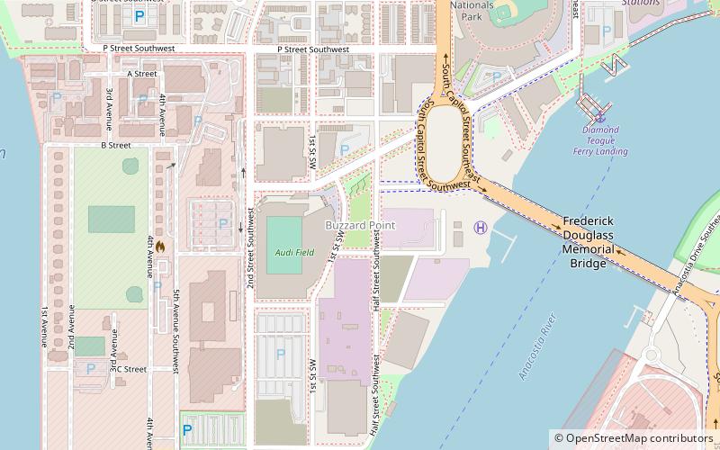
Map
Facts and practical information
Buzzard Point is an urbanized area located on the peninsula formed by the confluence of the Potomac and Anacostia Rivers in the southwest quadrant of Washington, D.C., United States. ()
Coordinates: 38°52'8"N, 77°0'40"W
Address
Southwest Washington (Southwest - Waterfront)Washington D.C.
ContactAdd
Social media
Add
Getting there by public transportation
Public transportation stops near this location
- Metro
- Bus
- Train
 Metro
Metro
- Calculate route4th St & N St SW 14 min walk
- Calculate routeM St SE & 4th St SE 20 min walk
- Calculate routeL 24 min walk
- Calculate routeM 24 min walk
- Calculate routeNavy Yard–Ballpark 16 min walk
- Calculate routeWaterfront 17 min walk
- Calculate routeL'Enfant 33 min walk
Day trips


Frequently Asked Questions (FAQ)
Which popular attractions are close to Buzzard Point?
Nearby attractions include James C. Dent House, Washington D.C. (5 min walk), Frederick Douglass Memorial Bridge, Washington D.C. (8 min walk), South Capitol Street, Washington D.C. (8 min walk), James Creek Marina, Washington D.C. (9 min walk).
How to get to Buzzard Point by public transport?
The nearest stations to Buzzard Point:
Bus
Metro
Train
Bus
- 4th St & N St SW • Lines: 74 (14 min walk)
- M St SE & 4th St SE • Lines: V4 (20 min walk)
Metro
- Navy Yard–Ballpark • Lines: Gr (16 min walk)
- Waterfront • Lines: Gr (17 min walk)
Train
- L'Enfant (33 min walk)