Trek Zone

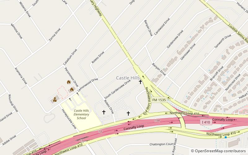
Castle Hills, San Antonio

#58 among attractions in San Antonio

Area
Castle Hills location map
Map

Facts and practical information

Alternative names: Area: 2.47 mi²Coordinates: 29°31'24"N, 98°31'0"W
Address

North San Antonio (Castle Hills)San Antonio United States

Contact
Social media
Add
Day trips

Castle Hills – popular in the area (distance from the attraction)

Nearby attractions include: North Star Mall, Alamo Quarry Market, Wonderland of the Americas, Oak Hills Country Club.

  • north star mall san antonio1.3 miE
  • alamo quarry market san antonio2.9 miSE
  • wonderland of the americas san antonio location map
    3 miSW
  • oak hills country club san antonio location map
    3.5 miSW
  • balcones heights san antonio location map
    3 miSW
  • fence at alamo cement company san antonio2.9 miSE
  • holocaust memorial museum of san antonio2.5 miNW
  • denman estate park san antonio2.8 miW
  • robert l b tobin land bridge san antonio2.5 miN
  • san pedro driving range par 3 san antonio2.5 miSE
  • oblate school of theology san antonio1.4 miSE

Frequently Asked Questions (FAQ)

How to get to Castle Hills by public transport?

The nearest stations to Castle Hills:

Bus
  • North Star Transit Center (29 min walk)

Where to next? Visit texas Texas region page or discover the top tourist attractions in United States.