Four Mile Run Trail, Arlington
Map
Facts and practical information
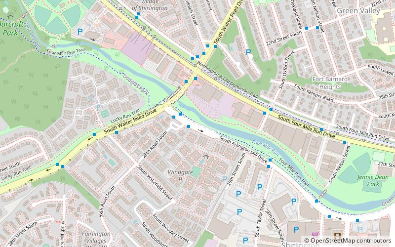
The Four Mile Run Trail is a 7-mile long, paved shared use path in Arlington County, Virginia. It runs along Four Mile Run from Benjamin Banneker Park in Falls Church to the Mount Vernon Trail near Ronald Reagan Washington National Airport, where Four Mile Run empties into the Potomac River. The trail runs roughly parallel to parts of the Washington & Old Dominion Railroad Trail as it follows Four Mile Run, sometimes on the other side of the stream. ()
Coordinates: 38°50'42"N, 77°5'43"W
Address
South Arlington (Shirlington)Arlington
ContactAdd
Social media
Add
Getting there by public transportation
Public transportation stops near this location
- Bus
 Bus
Bus
- Calculate routeS Arlington Mill Dr at 28th Rd S 1 min walk
- Calculate routeS Walter Reed Dr at S Four Mile Run Dr 3 min walk
- Calculate routeFour Mile Run at S Walter Reed Dr 4 min walk
Day trips


Frequently Asked Questions (FAQ)
Which popular attractions are close to Four Mile Run Trail?
Nearby attractions include Shirlington, Arlington (10 min walk), Signature Theatre, Arlington (11 min walk), Nauck, Arlington (12 min walk), Battery Garesche, Arlington (13 min walk).
How to get to Four Mile Run Trail by public transport?
The nearest stations to Four Mile Run Trail:
Bus
Bus
- S Arlington Mill Dr at 28th Rd S • Lines: 72, 77 (1 min walk)
- S Walter Reed Dr at S Four Mile Run Dr • Lines: 72, 75 (3 min walk)