Hebrew Tabernacle of Washington Heights, New York City
Map
Facts and practical information
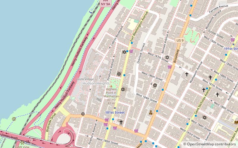
The Hebrew Tabernacle of Washington Heights is an historic domed Art Deco style building and Reform synagogue. It is located at 551 Fort Washington Avenue, on the corner of 185th Street, in the Washington Heights neighborhood of Manhattan in New York City. ()
Architectural style: Art DecoCoordinates: 40°51'13"N, 73°56'16"W
Address
Upper Manhattan (Washington Heights)New York City
ContactAdd
Social media
Add
Getting there by public transportation
Public transportation stops near this location
- Metro
- Bus
- Train
 Metro
Metro
- Calculate route181st Street 9 min walk
- Calculate route190th Street 11 min walk
- Calculate routeGeorge Washington Bridge Bus Station 9 min walk
- Calculate routeSaint Nicholas Avenue & West 176th Street 14 min walk
- Calculate routeAmsterdam Avenue & West 178th Street 16 min walk
- Calculate routeMorris Heights 24 min walk
Maps SubwayMaps
 Manhattan Buses
SubwayMapsManhattan BusesDay trips


Frequently Asked Questions (FAQ)
Which popular attractions are close to Hebrew Tabernacle of Washington Heights?
Nearby attractions include Fort Tryon Jewish Center, New York City (2 min walk), Hudson Heights, New York City (3 min walk), Khal Adath Jeshurun, New York City (4 min walk), Fort Washington Collegiate Church, New York City (5 min walk).
How to get to Hebrew Tabernacle of Washington Heights by public transport?
The nearest stations to Hebrew Tabernacle of Washington Heights:
Metro
Bus
Train
Metro
- 181st Street • Lines: 1, A (9 min walk)
- 190th Street • Lines: A (11 min walk)
Bus
- George Washington Bridge Bus Station (9 min walk)
- Saint Nicholas Avenue & West 176th Street • Lines: M3 (14 min walk)
Train
- Morris Heights (24 min walk)