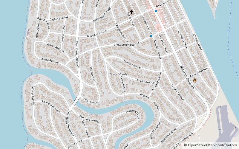
Davis Islands, Tampa
Map
Facts and practical information
Davis Islands is a Tampa neighborhood and archipelago on two islands in Hillsborough County, Florida. Its proximity to Downtown Tampa and its views of the Port of Tampa have made it a popular area to live. The area's population was 5,474 at the 2010 census. ()
Coordinates: 27°55'19"N, 82°27'20"W
Address
Davis IslandsTampa
ContactAdd
Social media
Add
Getting there by public transportation
Public transportation stops near this location
- Bus
 Bus
Bus
- Calculate routeArbor Pl @ South Davis Blvd 23 min walk
- Calculate routeDavis Boulevard @ One Davis Medical Building 27 min walk
- Calculate routeTampa General Hospital 27 min walk
Day trips


Frequently Asked Questions (FAQ)
How to get to Davis Islands by public transport?
The nearest stations to Davis Islands:
Bus
Bus
- Arbor Pl @ South Davis Blvd • Lines: 19 (23 min walk)
- Davis Boulevard @ One Davis Medical Building • Lines: 19 (27 min walk)