Hodges Square Historic District, New London
Facts and practical information
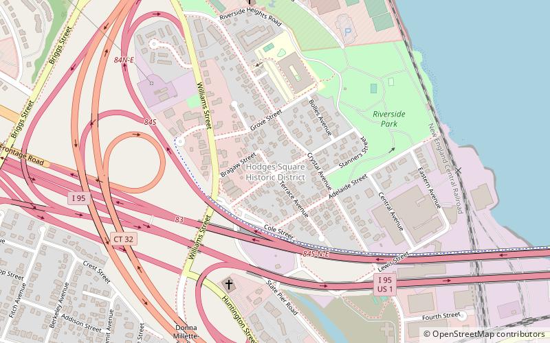
The Hodges Square Historic District of New London, Connecticut encompasses a working-class residential area north of the city's central business district. It is located between the campus of the United States Coast Guard Academy and Interstate 95, and is bounded on the west by Williams Street and the east by the Thames River. This area developed as a modest working-class residential area in the mid-19th century, when New London's economy began shifting from one based on maritime pursuits to one based on manufacturing. The area's residents were typically employed in nearby silk manufacturing operations, or by the Central Vermont Railroad, which had a roundhouse and service yard nearby. Hodges Square, a small cluster of commercial buildings, forms the economic center of the neighborhood. ()
East New LondonNew London
- Bus
- Train
- Ferry
 Bus
Bus
- Calculate routeCross Sound Ferry 22 min walk
- Calculate routeGreyhound Bus Station 23 min walk
- Calculate routeNew London 24 min walk
Hodges Square Historic District – popular in the area (distance from the attraction)
Nearby attractions include: St. James Episcopal Church, Garde Arts Center, Huntington Street Baptist Church, United States Coast Guard Academy.


Frequently Asked Questions (FAQ)
Which popular attractions are close to Hodges Square Historic District?
How to get to Hodges Square Historic District by public transport?
Ferry
- Cross Sound Ferry (22 min walk)
Bus
- Greyhound Bus Station (23 min walk)
Train
- New London (24 min walk)