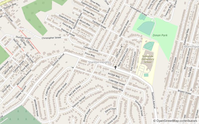
Stanton Heights, Pittsburgh
Map
Facts and practical information
Stanton Heights is a neighborhood in Pittsburgh, Pennsylvania's East End. It has zip codes of both 15201 and 15206, and has representation on Pittsburgh City Council by the council member for District 7. Stanton Heights is the home of PBF 7 Engine and the city's Arson Investigation Units, and is covered by PBP Zone 5 and the Bureau of EMS Medic 6. ()
Area: 0.73 mi²Coordinates: 40°28'53"N, 79°56'15"W
Address
East End (Stanton Heights)Pittsburgh
ContactAdd
Social media
Add
Getting there by public transportation
Public transportation stops near this location
- Bus
 Bus
Bus
- Calculate routeMain St at 6th St 24 min walk
Day trips


Frequently Asked Questions (FAQ)
Which popular attractions are close to Stanton Heights?
Nearby attractions include Morningside, Pittsburgh (11 min walk), Highland Park Residential Historic District, Pittsburgh (15 min walk), King Estate, Pittsburgh (18 min walk), Senator Robert D. Fleming Bridge, Pittsburgh (21 min walk).
How to get to Stanton Heights by public transport?
The nearest stations to Stanton Heights:
Bus
Bus
- Main St at 6th St • Lines: 1 (24 min walk)