Nora's Woods, Seattle
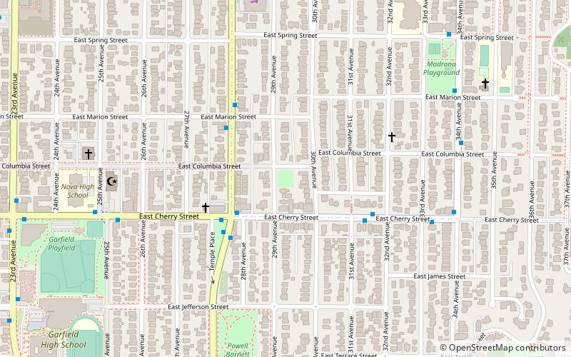
Map
Facts and practical information
Nora's Woods is an undeveloped city park and native plant garden in the Madrona neighborhood of Seattle, Washington. The 0.35-acre house lot-sized wooded area is named for Seattleite Nora Woods, who purchased the land in 1987 that was given to The Trust for Public Land after her death in 1989. Cleanup of the overgrown and neglected property by neighborhood volunteers to create the park began in 1996 or 1997. In 1998, it became a city park. ()
Elevation: 292 ft a.s.l.Coordinates: 47°36'32"N, 122°17'41"W
Address
Central Seattle (Madrona)Seattle
ContactAdd
Social media
Add
Getting there by public transportation
Public transportation stops near this location
- Bus
- Tram
 Bus
Bus
- Calculate routeMartin L King Jr Way & E Cherry St 3 min walk
- Calculate route14th & Washington 28 min walk
- Calculate route12th & Jackson 31 min walk
Day trips


Frequently Asked Questions (FAQ)
Which popular attractions are close to Nora's Woods?
Nearby attractions include Madrona, Seattle (5 min walk), Alvin Larkins Park, Seattle (12 min walk), Lake Washington Boulevard, Seattle (14 min walk), Madrona Park, Seattle (14 min walk).
How to get to Nora's Woods by public transport?
The nearest stations to Nora's Woods:
Bus
Tram
Bus
- Martin L King Jr Way & E Cherry St • Lines: 8 (3 min walk)
Tram
- 14th & Washington • Lines: First Hill Streetcar (28 min walk)
- 12th & Jackson • Lines: First Hill Streetcar (31 min walk)