Pacific Art League, Palo Alto
Map
Facts and practical information
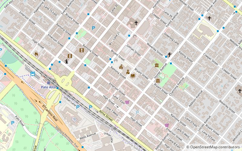
The Pacific Art League, formally known as the Palo Alto Art Club was founded in 1921 in Palo Alto, California and is a membership-run nonprofit arts organization, school, and gallery. The group is located in a historic building at 668 Ramona Street in downtown Palo Alto. ()
Coordinates: 37°26'38"N, 122°9'36"W
Address
Palo Alto (University South)Palo Alto
ContactAdd
Social media
Add
Getting there by public transportation
Public transportation stops near this location
- Bus
- Train
 Bus
Bus
- Calculate routeHamilton Avenue & Ramona Street 2 min walk
- Calculate routeWaverley Street & Hamilton Avenue 5 min walk
- Calculate routePalo Alto 8 min walk
- Calculate routeStanford 12 min walk
- Calculate routeCalifornia Avenue 37 min walk
Day trips


Frequently Asked Questions (FAQ)
Which popular attractions are close to Pacific Art League?
Nearby attractions include Museum of American Heritage, Palo Alto (4 min walk), Digital DNA, Palo Alto (4 min walk), Ramona Street Architectural District, Palo Alto (4 min walk), Palo Alto Medical Clinic, Palo Alto (4 min walk).
How to get to Pacific Art League by public transport?
The nearest stations to Pacific Art League:
Bus
Train
Bus
- Hamilton Avenue & Ramona Street • Lines: 21 (2 min walk)
- Waverley Street & Hamilton Avenue • Lines: 21 (5 min walk)
Train
- Palo Alto (8 min walk)
- Stanford (12 min walk)