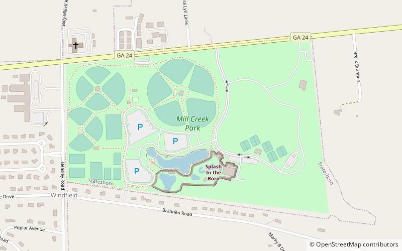
Mill Creek Regional Park, Statesboro
Map
Facts and practical information
Mill Creek Recreational Park is a park facility located in Statesboro, Georgia. A joint project of the city of Statesboro and Bulloch County, the park was designed by the landscape architecture firm of Lose & Associates. ()
Elevation: 194 ft a.s.l.Coordinates: 32°27'10"N, 81°44'20"W
Address
Statesboro
ContactAdd
Social media
Add
Day trips
Mill Creek Regional Park – popular in the area (distance from the attraction)
Nearby attractions include: Hanner Fieldhouse, Georgia Southern Botanical Garden, Splash in the Boro Waterpark & Aquatics Center, Bulloch County Courthouse.